
1952 Map of Moneta
USGS Topo · Published 1953About this map
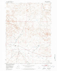
The Chicago Burlington and Quincy railroad cuts through the northeastern corner of this high-plains landscape, marking a vital transit corridor through Fremont County. This 1952 field-checked survey reveals an arid environment defined by seasonal drainages and local ranching operations. Significant family-named landmarks like the Kanson Ranch and Webb Ranch anchor the southern portion of the quadrangle, while the Moneta Hills rise to the northwest. The water management of the era is evident in the network of reservoirs and draws, including Moneta Reservoir, Frenchie Reservoir, and Graham Res. The terrain transitions from the broken draws of Linn Draw and Day Gulch into the expansive Alkali Flats, illustrating the challenging landscape navigated by early Wyoming settlers and ranchers. This document captures the remote character of the Missouri River Basin development area before more modern road networks expanded.
Find a feature on this map
23 named features on this map. Tap any name to fly to it.
Don’t see what you’re looking for? This feature index may not catch every label — zoom into the map to look around manually.
Map Details
Editions of this 1952 Moneta Map
2 editions found
Other maps of this area

1952 · Seventy-one Reservoir
USGS Topo · 1:24,000

1952 · Squaw Butte NE
USGS Topo · 1:24,000

1952 · Squaw Butte
USGS Topo · 1:24,000

1952 · Gates Butte
USGS Topo · 1:24,000

1952 · Lysite
USGS Topo · 1:24,000

1952 · Madden
USGS Topo · 1:24,000

1952 · Lysite SE
USGS Topo · 1:24,000

1952 · Moneta SE
USGS Topo · 1:24,000

1955 · Arminto
USGS Topo · 1:250,000

1958 · Arminto
USGS Topo · 1:250,000