
1952 Map of Squaw Butte
USGS Topo · Published 1953About this map
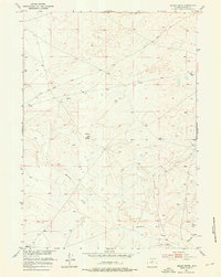
Squaw Butte rises as a central landmark in this 1952 topographic study of the Missouri River Basin development area. The landscape of Fremont County is defined by the winding course of Muskrat Creek and the intricate drainage of Chalk Hills Draw, illustrating a terrain where water management was critical for survival and industry. Human footprints are sparse but significant, marked by isolated infrastructure such as a Windmill and a remote Well. The map provides a look at early transportation routes through the scrub, including Scotty Road and Clark Road, which likely served ranching interests or early basin surveys. One notable insight into the changing utility of the land is the presence of a Ditch (Aban'd) near the southern creek bed, suggesting former irrigation or mining efforts that had already fallen out of use by the mid-twentieth century.
Find a feature on this map
8 named features on this map. Tap any name to fly to it.
Don’t see what you’re looking for? This feature index may not catch every label — zoom into the map to look around manually.
Map Details
Editions of this 1952 Squaw Butte Map
2 editions found
Other maps of this area

1952 · Seventy-one Reservoir
USGS Topo · 1:24,000

1952 · Squaw Butte NE
USGS Topo · 1:24,000

1952 · Ocla Draw
USGS Topo · 1:24,000

1952 · Moneta
USGS Topo · 1:24,000

1952 · Double Butte
USGS Topo · 1:24,000

1952 · Haybarn Hill
USGS Topo · 1:24,000

1952 · Love Ranch
USGS Topo · 1:24,000

1952 · Butte Well
USGS Topo · 1:24,000

1955 · Arminto
USGS Topo · 1:250,000

1955 · Casper
USGS Topo · 1:250,000