
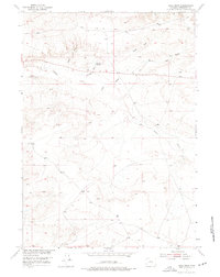
1952 Map of Ocla Draw
USGS Topo · Published 1953About this map
Picard Ranch and the Robinson Shearing Pens anchor this mid-century survey of the high desert landscape in Fremont County. The map provides a detailed view of the water management and livestock infrastructure essential to Wyoming ranching life during the early 1950s. Water distribution is traced through several catchments, including the Ocla Reservoir and Robinson Reservoir, which served the arid surroundings. The drainage network is clearly defined by Poison Creek and a system of namesake coulees such as Ocla Draw, Robinson Draw, and Scott Draw. This survey was conducted as part of a Department of the Interior program focused on the development of the Missouri River Basin, capturing the specialized land use of the region before modern ranching consolidation.
Find a feature on this map
11 named features on this map. Tap any name to fly to it.
Don’t see what you’re looking for? This feature index may not catch every label — zoom into the map to look around manually.
Map Details
Editions of this 1952 Ocla Draw Map
2 editions found
Other maps of this area

1951 · Fuller Reservoir
USGS Topo · 1:24,000

1951 · Bonneville
USGS Topo · 1:24,000

1951 · Shoshoni
USGS Topo · 1:24,000

1952 · Squaw Butte NE
USGS Topo · 1:24,000

1952 · Squaw Butte
USGS Topo · 1:24,000

1952 · Gates Butte
USGS Topo · 1:24,000

1952 · Picard Ranch
USGS Topo · 1:24,000

1952 · Haybarn Hill
USGS Topo · 1:24,000

1955 · Thermopolis
USGS Topo · 1:250,000

1955 · Arminto
USGS Topo · 1:250,000