
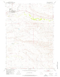
1951 Map of Shoshoni
USGS Topo · Published 1953About this map
The town of Shoshoni serves as a critical railway and road junction in this 1951 study of the Wyoming landscape. Located at the meeting point of the Chicago and North Western railroad lines, the settlement is positioned just north of the meandering Poison Creek. The map documents a transition in land use, from the structured grid of the town site to the more isolated agricultural markers of the surrounding basin, such as the Carver Homestead (Aband) located south along Muskrat Creek.
Find a feature on this map
13 named features on this map. Tap any name to fly to it.
Don’t see what you’re looking for? This feature index may not catch every label — zoom into the map to look around manually.
Map Details
Editions of this 1951 Shoshoni Map
2 editions found
Other maps of this area

1950 · Bonneville SW
USGS Topo · 1:24,000

1951 · Fuller Reservoir
USGS Topo · 1:24,000

1951 · Indian Butte
USGS Topo · 1:24,000

1951 · Hidden Valley
USGS Topo · 1:24,000

1951 · Bonneville
USGS Topo · 1:24,000

1952 · Ocla Draw
USGS Topo · 1:24,000

1952 · Picard Ranch
USGS Topo · 1:24,000

1952 · Haybarn Hill
USGS Topo · 1:24,000

1955 · Thermopolis
USGS Topo · 1:250,000

1955 · Arminto
USGS Topo · 1:250,000