
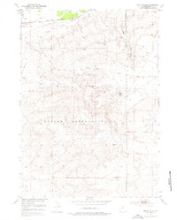
1951 Map of Indian Butte
USGS Topo · Published 1953About this map
The Wind River Reservation dominates this central Wyoming landscape, where the Chicago and North Western railway corridor cuts through the northern reaches near the Wind River. This 1950s survey captures the intersection of critical infrastructure and a traditional tribal landscape, marked clearly by the Reservation Boundary and the Wind River Base Line. A network of water sources, including Horsethief Springs, Gerton Spring, and Drip Spring, highlights the essential hydrology of this arid region. High points like Indian Butte overlook a terrain shaped by Horsethief Gulch and the industrial activity at the Gravel Pit. The presence of the Telephone Line and Nebo Road suggests a developing connectivity in the mid-century era, balancing the remote nature of the terrain with emerging transit and utility corridors.
Find a feature on this map
17 named features on this map. Tap any name to fly to it.
Don’t see what you’re looking for? This feature index may not catch every label — zoom into the map to look around manually.
Map Details
Editions of this 1951 Indian Butte Map
3 editions found
Other maps of this area

1950 · Riverton East
USGS Topo · 1:24,000

1951 · Fuller Reservoir
USGS Topo · 1:24,000

1951 · Hidden Valley
USGS Topo · 1:24,000

1951 · Shoshoni
USGS Topo · 1:24,000

1952 · Riverton NE
USGS Topo · 1:24,000

1953 · Arapahoe NE
USGS Topo · 1:24,000

1953 · Campbell Ridge
USGS Topo · 1:24,000

1955 · Thermopolis
USGS Topo · 1:250,000

1955 · Lander
USGS Topo · 1:250,000
1957 · Hidden Valley
USGS Topo · 1:24,000