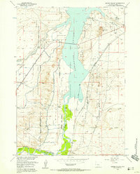
1957 Map of Hidden Valley
USGS Topo · Published 1958About this map
The Wind River Indian Reservation dominates this mid-century landscape, where the waters of the Wind River meet the southern reaches of the Boysen Reservoir. The intricate irrigation network of the Riverton Reclamation Area Withdrawal is clearly visible through features like the Fivemile Ditch and Pilot Canal, illustrating the region's managed water economy. Local commerce and community life are marked by the Valley View Store and a Drive-in Theater situated along the Chicago and North Western rail line. Genealogists and local historians can locate the Lake View Cemetery overlooking Poison Creek, while topographic landmarks such as Water Tank Hill and various Gravel Pits provide a detailed look at the era's physical and industrial footprint.
Find a feature on this map
29 named features on this map. Tap any name to fly to it.
Don’t see what you’re looking for? This feature index may not catch every label — zoom into the map to look around manually.
Map Details
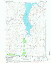
Editions of this 1957 Hidden Valley Map
2 editions found
Other maps of this area

1950 · Riverton East
USGS Topo · 1:24,000

1950 · Bonneville SW
USGS Topo · 1:24,000

1951 · Mexican Pass SE
USGS Topo · 1:24,000

1951 · Fuller Reservoir
USGS Topo · 1:24,000

1951 · Indian Butte
USGS Topo · 1:24,000

1951 · Hidden Valley
USGS Topo · 1:24,000

1951 · Bonneville
USGS Topo · 1:24,000

1951 · Shoshoni
USGS Topo · 1:24,000

1952 · Riverton NE
USGS Topo · 1:24,000

1955 · Thermopolis
USGS Topo · 1:250,000