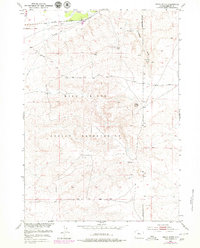
1951 Map of Indian Butte
USGS Topo · Published 1979About this map
The Wind River Indian Reservation landscape is defined here by its intersection with major industrial corridors in the mid-20th century. Highlighting the northern section of the map, the Chicago and North Western railway runs parallel to the Wind River, tracing a narrow path of infrastructure through the high plains. A network of essential services, including a Telephone Line and Pipe Line, follows this same transit spine, signaling the region's importance as a mid-century energy and communications conduit.
Find a feature on this map
17 named features on this map. Tap any name to fly to it.
Don’t see what you’re looking for? This feature index may not catch every label — zoom into the map to look around manually.
Map Details
Editions of this 1951 Indian Butte Map
3 editions found
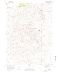
Other maps of this area

1950 · Riverton East
USGS Topo · 1:24,000

1951 · Fuller Reservoir
USGS Topo · 1:24,000

1951 · Indian Butte
USGS Topo · 1:24,000

1951 · Hidden Valley
USGS Topo · 1:24,000

1951 · Shoshoni
USGS Topo · 1:24,000

1952 · Riverton NE
USGS Topo · 1:24,000

1953 · Arapahoe NE
USGS Topo · 1:24,000

1953 · Campbell Ridge
USGS Topo · 1:24,000

1955 · Thermopolis
USGS Topo · 1:250,000

1955 · Lander
USGS Topo · 1:250,000