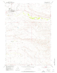
1951 Map of Shoshoni
USGS Topo · Published 1976About this map
Shoshoni serves as the central hub of this 1951 landscape, situated at a critical junction of the Chicago and North Western railroad. The town's grid is clearly defined against the arid terrain of central Wyoming, where the drainage patterns of Poison Creek and Muskrat Creek dominate the topography. These intermittent waterways suggest a landscape where water management was paramount for survival and settlement.
Find a feature on this map
8 named features on this map. Tap any name to fly to it.
Don’t see what you’re looking for? This feature index may not catch every label — zoom into the map to look around manually.
Map Details
Editions of this 1951 Shoshoni Map
2 editions found
Other maps of this area

1950 · Bonneville SW
USGS Topo · 1:24,000

1951 · Fuller Reservoir
USGS Topo · 1:24,000

1951 · Indian Butte
USGS Topo · 1:24,000

1951 · Hidden Valley
USGS Topo · 1:24,000

1951 · Bonneville
USGS Topo · 1:24,000

1951 · Shoshoni
USGS Topo · 1:24,000

1952 · Ocla Draw
USGS Topo · 1:24,000

1952 · Picard Ranch
USGS Topo · 1:24,000

1952 · Haybarn Hill
USGS Topo · 1:24,000

1955 · Thermopolis
USGS Topo · 1:250,000