
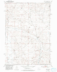
1952 Map of Moneta SE
USGS Topo · Published 1953About this map
The Meigh Ranch serves as a central point of human activity within this 1952 topographic study of the High Plains, situated near the boundary between Fremont County and Natrona County. The landscape is defined by its drainage systems and geological landmarks, including the prominent Black Rocks and various elevations such as Herder and Butte. Water management in this arid environment is evidenced by the presence of a Ditch (Aband), reflecting shifts in local land use and irrigation efforts during the mid-century. Several Windmill sites are scattered across the terrain, indicating the importance of groundwater for cattle ranching. The mapping of Deer Creek and Canyon Creek reveals the natural corridors through which seasonal water moves across this expansive Wyoming territory during the early 1950s.
Find a feature on this map
9 named features on this map. Tap any name to fly to it.
Don’t see what you’re looking for? This feature index may not catch every label — zoom into the map to look around manually.
Map Details
Editions of this 1952 Moneta SE Map
2 editions found
Other maps of this area

1952 · Seventy-one Reservoir
USGS Topo · 1:24,000

1952 · Moneta
USGS Topo · 1:24,000

1952 · Arminto SW
USGS Topo · 1:24,000

1952 · Love Ranch
USGS Topo · 1:24,000

1952 · Madden
USGS Topo · 1:24,000

1952 · Arminto NW
USGS Topo · 1:24,000

1952 · Miles Ranch
USGS Topo · 1:24,000

1952 · Ervay Basin
USGS Topo · 1:24,000

1955 · Arminto
USGS Topo · 1:250,000

1955 · Casper
USGS Topo · 1:250,000