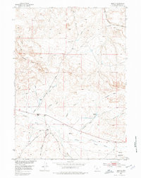
1952 Map of Moneta
USGS Topo · Published 1977About this map
The Chicago Burlington and Quincy railroad line cuts through the arid High Plains of central Wyoming in this mid-century survey. Ranching operations like the Kanson Ranch and Webb Ranch define the local human geography, situated near the seasonal drainages of Poison Creek and Moneta Draw. The landscape is a complex network of draws and forks, including the West Fork Graham Creek and East Fork Moneta Draw, which feed into natural basins and man-made water points like Frenchie Reservoir.
Find a feature on this map
25 named features on this map. Tap any name to fly to it.
Don’t see what you’re looking for? This feature index may not catch every label — zoom into the map to look around manually.
Map Details
Editions of this 1952 Moneta Map
2 editions found
Other maps of this area

1952 · Seventy-one Reservoir
USGS Topo · 1:24,000

1952 · Squaw Butte NE
USGS Topo · 1:24,000

1952 · Squaw Butte
USGS Topo · 1:24,000

1952 · Gates Butte
USGS Topo · 1:24,000

1952 · Moneta
USGS Topo · 1:24,000

1952 · Lysite
USGS Topo · 1:24,000

1952 · Madden
USGS Topo · 1:24,000

1952 · Lysite SE
USGS Topo · 1:24,000

1952 · Moneta SE
USGS Topo · 1:24,000

1955 · Arminto
USGS Topo · 1:250,000