Old Maps of Morton, Wyoming for Metal Detecting
Plan your next treasure hunt with 9 historic maps of Morton. Find old homesites, ghost towns, trails, and gathering spots that may be lost to time — perfect for identifying promising metal detecting locations.
- Locate forgotten sites: Uncover places like long-lost settlements, abandoned rail lines, or gathering spots.
- Plan better hunts: Use map overlays combined with LiDAR or satellite views to narrow in on historically rich areas.
- Made for detectorists: Thousands of hobbyists use these maps to discover relics, coins, and hidden history.
Use these historic maps to boost your research and find new opportunities beneath the surface of Morton.
Morton, WY maps
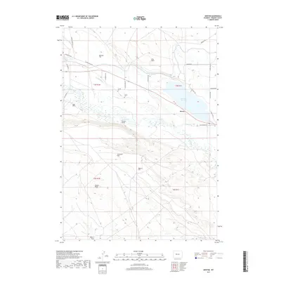
(9)- 1951 Map of Morton, 1953 Print
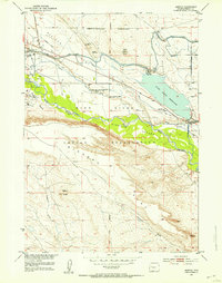 1951 Morton1953 Print · USGSFremont County's high plains meet industrial reclamation in the early 1950s, showing a landscape shaped by irrigation and coal. Genealogists and historians can trace the Riverton Reclamation Project near the Chavez Cem and the Mead Coal Mine.
 - 1955 Map of Thermopolis, 1969 Print
 1955 Thermopolis1969 Print · USGSMid-century Wyoming comes alive in this survey of the Wind River basin and the high Absaroka peaks. Trace the roots of oil and water development through the Hamilton Dome Oil Field and the Boysen Reservoir, or locate local landmarks like the Wyoming Industrial Institute and St. Stephens.2 unique versions available
 - 1958 Map of Thermopolis
 1958 Thermopolis1958 Print · USGSThe Bighorn Basin and Wind River Reservation are shown here in the late fifties, during a period of significant petroleum and agricultural growth. Genealogists and historians can trace rail-towns like Gebo, energy hubs like the Hamilton Dome Oil Field, and the layout of Fort Washakie.2 unique versions available
 - 1959 Map of Morton, 1961 Print
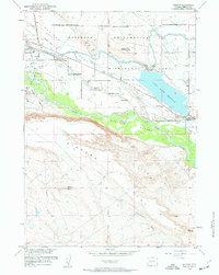 1959 Morton1961 Print · USGSThe Fremont County high plains are captured here in the late fifties, showcasing a complex network of reclamation projects and energy production. Researchers can locate family landmarks like Hurtado Cem, trace the Pilot Butte Oil Field, and follow the Wyoming Canal through the Wind River Indian Reservation Boundary.3 unique versions available
 - 1962 Map of Thermopolis
 1962 Thermopolis1962 Print · USGSThe Wind River and Bighorn basins are meticulously mapped in the early sixties, showing the vital irrigation and rail networks of the era. Genealogists and historians can locate specific landmarks like the Duncan Ranch School, the Wyoming Industrial Institute, and the Hamilton Dome oil field.
 - 2012 Map of Morton, 2012 Print
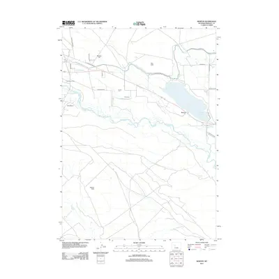 2012 Morton2012 Print · USGSCovers Morton, including Fremont County, United States, and other nearby areas
 - 2015 Map of Morton, 2015 Print
 2015 Morton2015 Print · USGSCovers Morton, including Fremont County, United States, and other nearby areas
 - 2017 Map of Morton, 2017 Print
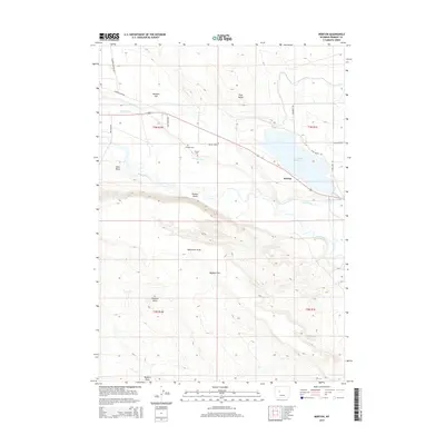
 2017 Morton2017 Print · USGSCovers Morton, including Fremont County, United States, and other nearby areas
 - 2021 Map of Morton, 2021 Print
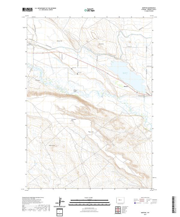 2021 Morton2021 Print · USGSThe Fremont County plains come alive in this contemporary survey of the river-fed agricultural lands near Morton. Genealogists and historians can trace family ties at Hurtado Cem and Chavez Cem or follow the vital irrigation paths of Hurtado Ditch.
End of results
Showing maps 1-9 of 9
Top cities near Morton
Frequently asked questions
- What are the different types of historical maps available for Morton?
- What is the oldest map of Morton?
- Where can I purchase historical maps of Morton for my home or office?
- Where can I download high-res historical maps of Morton?
- Are there historical topographic maps available for Morton?
- Is there historical aerial imagery available for Morton?
- Where are historical maps of Morton sourced from?