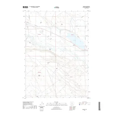
2017 Map of Morton
USGS Topo · Published 2017About this map
Morton serves as a focal point for this Fremont County landscape, situated near the managed waters of the Pilot Butte Reservoir. This 2017 survey illustrates the intricate water management systems of the region, featuring the Aragon Ditch and Hurtado Ditch which navigate the terrain between Mexican Flat and Bighorn Flat. These irrigation networks are essential components of the local agricultural geography, supporting the valley even as the terrain rises toward prominent landforms like Pilot Butte and Bighorn Butte.
Find a feature on this map
30 named features on this map. Tap any name to fly to it.
Don’t see what you’re looking for? This feature index may not catch every label — zoom into the map to look around manually.
Map Details
Editions of this 2017 Morton Map
This is the sole edition of this map. No revisions or reprints were ever made.
Other maps of this area

1950 · Pavillion
USGS Topo · 1:24,000

1950 · Pavillion Butte
USGS Topo · 1:24,000

1951 · Lookout Butte SW
USGS Topo · 1:24,000

1951 · Mule Butte
USGS Topo · 1:24,000

1951 · Morton
USGS Topo · 1:24,000

1951 · Fort Washakie
USGS Topo · 1:24,000

1951 · Lookout Butte
USGS Topo · 1:24,000

1951 · Argo Butte
USGS Topo · 1:24,000

1951 · Ethete
USGS Topo · 1:24,000

1955 · Thermopolis
USGS Topo · 1:250,000