
1951 Map of Argo Butte
USGS Topo · Published 1953About this map
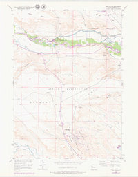
The Wind River valley dominates this 1951 landscape, serving as the focal point for significant irrigation and industrial developments in central Wyoming. At the Diversion Dam, water is channeled into the Wyoming Canal as part of the Riverton Reclamation Project, a system that transformed this arid terrain into productive land. This era of resource extraction is clearly visible through the presence of the Steamboat Butte Oil Field in the north and the Winkleman Dome Oil Field to the south.
Find a feature on this map
32 named features on this map. Tap any name to fly to it.
Don’t see what you’re looking for? This feature index may not catch every label — zoom into the map to look around manually.
Map Details
Editions of this 1951 Argo Butte Map
2 editions found
Other maps of this area

1951 · Lookout Butte SW
USGS Topo · 1:24,000

1951 · Morton
USGS Topo · 1:24,000

1951 · Fort Washakie
USGS Topo · 1:24,000

1951 · Bull Lake East
USGS Topo · 1:24,000

1951 · Lookout Butte
USGS Topo · 1:24,000

1951 · Ethete
USGS Topo · 1:24,000

1952 · Wise Flat
USGS Topo · 1:24,000

1952 · Crowheart Butte
USGS Topo · 1:24,000

1955 · Thermopolis
USGS Topo · 1:250,000

1958 · Thermopolis
USGS Topo · 1:250,000