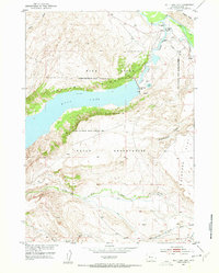
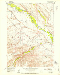
1951 Map of Bull Lake East
USGS Topo · Published 1953About this map
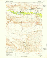
The Wind River Indian Reservation dominates the landscape of this 1951 survey, illustrating a region defined by water management and natural topographic boundaries. The massive Bull Lake is held by the Bull Lake Dam, a central piece of the Riverton Reclamation Project (Withdrawal Area) designed to manage the high-altitude water supply. Flanked by the prominent elevations of Cedar Ridge and Bull Ridge, the lake feeds into the Wind River to the northeast. Human presence is concentrated near the water at Bull Lake Lodge, while the southern expanse transitions into the wide drainage basins of North Fork Sage Creek and Middle Fork Sage Creek. The map documents the infrastructure of the era, from the winding Telephone Line to various gaging stations and gravel pits that supported local development and irrigation efforts.
Find a feature on this map
22 named features on this map. Tap any name to fly to it.
Don’t see what you’re looking for? This feature index may not catch every label — zoom into the map to look around manually.
Map Details
Editions of this 1951 Bull Lake East Map
2 editions found
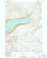
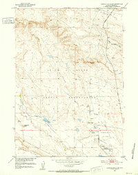
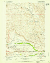
Other maps of this area
1951 · Lookout Butte SW
USGS Topo · 1:24,000
1951 · Fort Washakie
USGS Topo · 1:24,000
1951 · Argo Butte
USGS Topo · 1:24,000
1952 · Wise Flat
USGS Topo · 1:24,000
1952 · Crowheart Butte
USGS Topo · 1:24,000
1952 · Bull Lake West
USGS Topo · 1:24,000
1952 · Crowheart
USGS Topo · 1:24,000
1952 · St. Lawrence Basin
USGS Topo · 1:24,000

1955 · Thermopolis
USGS Topo · 1:250,000

1958 · Thermopolis
USGS Topo · 1:250,000