1960s Maps of Goshen County, Wyoming
Explore 33 historic maps of Goshen County from the 1960s. These maps offer a rare glimpse into what life looked like during the 1960s — showing old roads, neighborhoods, homes, and landmarks that have changed or disappeared over time.
Whether you're researching your family's past, planning a metal detecting trip, or studying how Goshen County's landscape evolved across the 1960s, these high-resolution maps are a powerful tool for exploring the history of this region.
- Focus on a specific era: All maps on this page are from the 1960s, giving you a focused view of this time period.
- See what’s changed: Compare century-old streets, trails, and buildings to today's modern landscape using overlays and satellite layers.
- Research with precision: Use these maps for genealogy, historical research, land use analysis, or educational projects.
- View, download, or print: Maps are fully viewable online in high resolution, and can be downloaded or printed for your own records.
Start exploring Goshen County's history through authentic maps from the 1960s. This is your window into the past.
Goshen County, WY maps
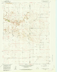
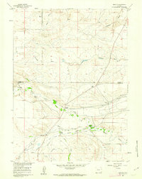
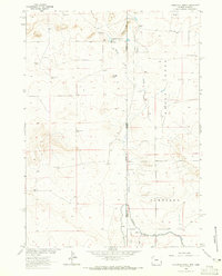
(33)- 1960 Map of Tremain
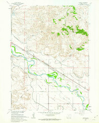
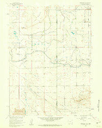
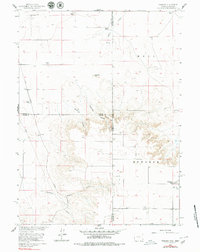 1960 Tremain1960 Print · USGSThe high plains of the Wyoming-Nebraska border come into focus in 1960, showing a landscape defined by cattle ranching and rail infrastructure. Researchers can trace historic family-named homesteads like Bull Canyon Ranch and Spahr Ranch alongside the Epworth Cem.3 unique versions available
 - 1960 Map of Habig Spring, 1962 Print
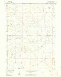
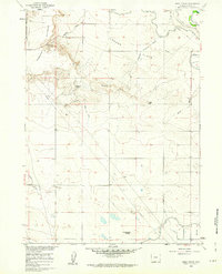 1960 Habig Spring1962 Print · USGSThis Goshen County landscape was captured in the early sixties as irrigation infrastructure reshaped the high plains near the historic river valley. Genealogists and historians can trace the paths of the Fort Laramie Canal and Emigrant Trail Canal past landmarks like Whitehorse Butte and Habig Spring.3 unique versions available
 - 1960 Map of Huntley, 1962 Print
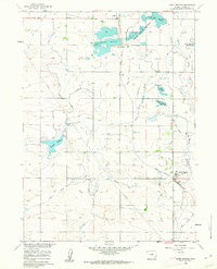
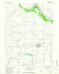
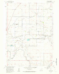 1960 Huntley1962 Print · USGSAgricultural Goshen County comes into focus in the early sixties, showing the rural communities and irrigation networks of the Wyoming plains. Genealogists and researchers can trace local landmarks like Huntley, Holly, and the Hillview Home alongside the Fort Laramie Canal.3 unique versions available
 - 1960 Map of Veteran, 1962 Print
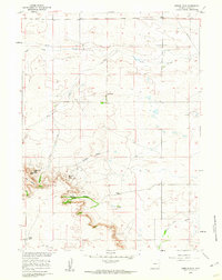
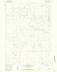 1960 Veteran1962 Print · USGSIn the early 1960s, this Goshen County landscape centered on the vital water-sharing infrastructure of the Wyoming plains. Researchers can trace the Union Pacific line to Veteran or locate family landmarks like the E G House Ranch and Millies Hill.2 unique versions available
 - 1960 Map of Diamond Flat, 1962 Print
 1960 Diamond Flat1962 Print · USGSThe Goshen County landscape near Diamond Flat was surveyed in the early sixties, showing a ranching region defined by its watercourses and landmarks. Family historians and researchers can locate the Bear Creek Ch and trace the paths of Fox Creek and Lone Tree Canyon.
 - 1960 Map of Mc Compsey Pass, 1962 Print
 1960 Mc Compsey Pass1962 Print · USGSThe Wyoming-Nebraska borderlands in the early sixties reveal a landscape defined by isolated ranches and essential water sources. Trace the movement of livestock and early settlers through Mc Compsey Pass, the Spahr Ranch, and remote landmarks like Devils Armchair.3 unique versions available
 - 1960 Map of Petsch Reservoir, 1962 Print
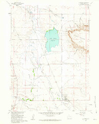
 1960 Petsch Reservoir1962 Print · USGSLaramie and Goshen counties were defined by isolated ranching outposts and vital irrigation works in the early sixties. Genealogists can locate family landmarks like Gregory Ranch and Johnson Ranch or trace the route of the Union Pacific rail line.2 unique versions available
 - 1960 Map of Hawk Springs, 1962 Print
 1960 Hawk Springs1962 Print · USGSGoshen County, Wyoming, is defined by its mid-century irrigation network and rail connectivity in this 1960s study. Researchers can trace the Union Pacific line through Hawk Springs and locate early water landmarks like Bump-Sullivan Reservoir and Sinnard Reservoir.2 unique versions available
 - 1960 Map of Needle Rock, 1962 Print
 1960 Needle Rock1962 Print · USGSGoshen County ranching country is captured here in the early sixties, showing the remote homesteads and rugged breaks above the Platte River basin. Genealogists and historians can locate the Trelona (Site) and family landmarks like Otto Ranch or Needle Rock.3 unique versions available
 - 1960 Map of Barnes, 1962 Print
 1960 Barnes1962 Print · USGSGoshen County at the start of the 1960s shows a landscape defined by the North Platte River and deep frontier history. Trace the path of the Emigrant Trail near the site of the Grattan Massacre Historical Mon and the Fort Laramie Military Reservation.3 unique versions available
 - 1960 Map of Lyman, 1962 Print
 1960 Lyman1962 Print · USGSThe Nebraska-Wyoming border comes alive in the early sixties, showing the agricultural heart of the North Platte valley. Researchers can trace the Emigrant Trail, locate the Historical Mon, and study the rail sidings of Lyman and Henry.3 unique versions available
 - 1960 Map of Rocky Hollow, 1962 Print
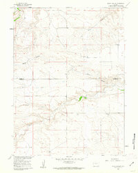 1960 Rocky Hollow1962 Print · USGSThe high plains along the border of Goshen and Laramie Counties are captured here in the early sixties. Researchers can trace the winding paths of Horse Creek and Cattail Creek or locate local landmarks like Rocky Hollow.
 - 1960 Map of Kessler Gap, 1962 Print
 1960 Kessler Gap1962 Print · USGSGoshen County ranching country is captured here during the early sixties, showing the vital water systems of the Missouri River Basin development. Trace the routes of the Kessler Ditch and Lovercheck Ditch alongside landmarks like Castle Rocks and Squaw Rock.3 unique versions available
 - 1960 Map of Meriden, 1962 Print
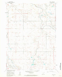
 1960 Meriden1962 Print · USGSHigh plains ranching in Laramie and Goshen counties comes alive in the early sixties, showing the vital irrigation networks of the day. Trace family holdings like Petsch Ranch and Hunter Ranch alongside the Meriden Post Office.2 unique versions available
 - 1960 Map of La Grange, 1962 Print
 1960 La Grange1962 Print · USGSThe ranching and irrigation landscape of Goshen County is captured here in the early sixties, centered on the community of La Grange. Researchers can trace the legacy of local cattle operations at Wycross Ranch and the vital water network of Hawk Springs Ditch.2 unique versions available
 - 1960 Map of Duroc, 1962 Print
 1960 Duroc1962 Print · USGSGoshen County agriculture and infrastructure are captured here at the start of the 1960s, showing a landscape defined by water management. Genealogists and historians can trace the Union Pacific rail line and the reach of the Fort Laramie Canal past Duroc.3 unique versions available
 - 1960 Map of Cottier, 1962 Print
 1960 Cottier1962 Print · USGSEastern Wyoming's high plains meet the irrigated North Platte valley in the early sixties, a landscape shaped by both pioneer routes and modern water engineering. Genealogists and historians can trace the Emigrant Trail past the Rock Ranch (Historical) and the rural settlement at Cottier.3 unique versions available
 - 1960 Map of Robb Draw, 1962 Print
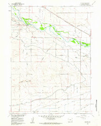
 1960 Robb Draw1962 Print · USGSThe high plains of the Wyoming and Nebraska border in the early sixties reveal a landscape defined by large-scale irrigation and isolated rural schoolhouses. Researchers can trace the massive Fort Laramie Canal or locate local landmarks like Kiowa Sch and Togy Mound.3 unique versions available
 - 1960 Map of Yoder, 1962 Print
 1960 Yoder1962 Print · USGSSoutheast Wyoming’s high plains and irrigation networks are on full display during the early 1960s. Genealogists and local historians can trace the Union Pacific rail corridor through Yoder and locate the sprawling Greasewood Ranch and Goshen Hole (Springer) Reservoir.3 unique versions available
 - 1963 Map of Torrington SE, 1965 Print
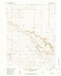
 1963 Torrington SE1965 Print · USGSThe high plains of the Wyoming-Nebraska border are captured here in the early 1960s, showing the intersection of pioneer history and modern irrigation. Researchers can trace the path of the Emigrant Trail near the North Platte River and locate local sites like Hunton Meadows and Henry.
 - 1963 Map of Lingle, 1965 Print
 1963 Lingle1965 Print · USGSThe irrigation and rail landscape of Goshen County is captured here in the early sixties. Researchers can trace the Emigrant Trail across the plains or locate family roots at Valley View Cem and Lingle Cem.3 unique versions available
 - 1963 Map of Tea Kettle Rock, 1965 Print
 1963 Tea Kettle Rock1965 Print · USGSGoshen County in the early 1960s reveals a landscape of high plains and remote industrial markers during the Missouri River Basin development era. Local history researchers can trace landmarks like Tea Kettle Rock, find the rural Landing Strip, and locate a small Sandpit.2 unique versions available
 - 1963 Map of Carpenter Ranch, 1965 Print
 1963 Carpenter Ranch1965 Print · USGSThe Wyoming and Nebraska high plains are captured here in the early sixties, showing a ranching landscape tied to the state line. Genealogists and historians can locate family outposts like Duncan Place, James, and numerous named water points including Wildy Windmill.2 unique versions available
 - 1963 Map of Torrington, 1965 Print
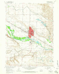 1963 Torrington1965 Print · USGSTorrington and the North Platte River valley are shown in the early sixties, a landscape where historical overland routes meet mid-century irrigation and rail. Researchers can trace the Emigrant and North Platte Trail alongside the Chicago Burlington and Quincy railroad and landmarks like St Josephs Orphanage.2 unique versions available
 - 1963 Map of Dickinson Hill, 1967 Print
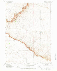 1963 Dickinson Hill1967 Print · USGSThe high plains of Platte and Goshen Counties are documented here in the early sixties, centered on the striking escarpment of the Goshen Hole Rim. Researchers can trace old ranching landmarks and infrastructure such as Baker Ranch, the Wind Charger, and Swan.2 unique versions available
Showing maps 1-25 of 33
Top cities of Goshen County
- Torrington historical maps
- Lingle historical maps
- La Grange historical maps
- Fort Laramie historical maps
- Yoder historical maps
Frequently asked questions
- What are the different types of historical maps available for Goshen County?
- What is the oldest map of Goshen County?
- Where can I purchase historical maps of Goshen County for my home or office?
- Where can I download high-res historical maps of Goshen County?
- Are there historical topographic maps available for Goshen County?
- Is there historical aerial imagery available for Goshen County?
- Where are historical maps of Goshen County sourced from?