Old Maps of Goshen County, Wyoming for Genealogy
Trace your family roots with 176 historic maps of Goshen County. These high-res maps reveal old neighborhoods, homesites, landmarks, and streets — helping you uncover where your ancestors lived and how the area evolved over time.
- Explore historic neighborhoods: Identify where your relatives may have lived in the 1800s or 1900s.
- Compare maps over time: Trace the changes in streets, buildings, and landmarks for multi-generational research.
- Perfect for genealogy & ancestry research: Used by family historians and researchers to map out lineage and migration.
These maps are an incredible resource for exploring your personal connection to Goshen County's past.
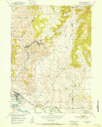
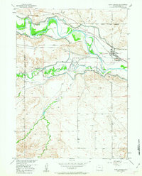
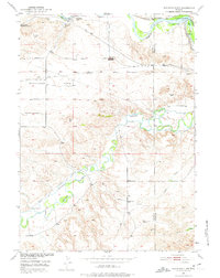
Goshen County, WY maps
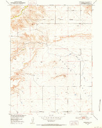
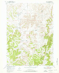
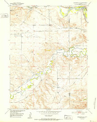
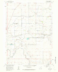
(176)- 1896 Map of Patrick
 1896 Patrick1896 Print · USGSEastern Wyoming ranching life is frozen in time during the mid-1890s, when family-run operations dominated the high plains. Genealogists can trace early homesteads like Nolan's Ranch, Sturdivant's Ranch, and the early settlement at Torrington.7 unique versions available
 - 1896 Map of Hartville
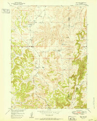
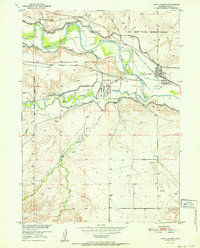
 1896 Hartville1896 Print · USGSSoutheast Wyoming in the late nineteenth century was a territory of vital river crossings and early industry. Researchers can trace the junction of the Laramie River and North Platte River near Fort Laramie and locate early rail hubs at Wheatland and Wendover.
 - 1899 Map of Goshen Hole
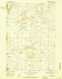
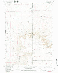
 1899 Goshen Hole1899 Print · USGSThe High Plains of the Wyoming-Nebraska borderlands come into focus at the close of the nineteenth century. Researchers can trace the early cattle ranching economy through named homesteads like Greasewood Ranch and Robb's Ranch, and locate landmarks such as Ninemile Rock.4 unique versions available
 - 1901 Map of Hartville
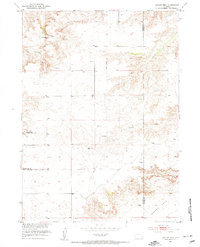
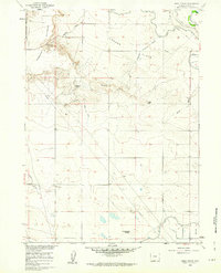
 1901 Hartville1901 Print · USGSEastern Wyoming at the turn of the century reveals a landscape defined by the arrival of the rails and the legacy of the frontier. Genealogists can trace family ranching sites like Dotys Ranch or early towns such as Hartville and Fort Laramie.2 unique versions available
 - 1950 Map of Rockeagle, 1952 Print
 1950 Rockeagle1952 Print · USGSGoshen County ranching and military history are preserved here at the start of the 1950s. Researchers can locate the Old Doty Ranch Site, the expansive Fort Laramie Military Reservation (Abandoned), and the settlement of Rockeagle.5 unique versions available
 - 1950 Map of Guernsey, 1952 Print
 1950 Guernsey1952 Print · USGSThe mining and ranching corridors of Platte County come to life in the mid-century, showing the industrial pulse of the Sunrise and Hartville districts. Trace the physical legacy of the Oregon Trail alongside active rail lines and mines like the Chicago Mine.4 unique versions available
 - 1950 Map of Casebier Hill, 1952 Print
 1950 Casebier Hill1952 Print · USGSGoshen County ranching and water resources are meticulously documented in the early 1950s, showing a landscape defined by named draws and high ridges. Researchers can locate the Old Government Farm, Meyers Ranch, and the route of Fort Laramie Road.2 unique versions available
 - 1950 Map of Fort Laramie, 1963 Print
 1950 Fort Laramie1963 Print · USGSFort Laramie and its surrounding river valley are captured here at mid-century as the historic military site transitioned into a national monument. Genealogists and historians can trace the intersection of the Chicago Burlington and Quincy railroad with the Fort Laramie Canal and the local Cem.3 unique versions available
 - 1950 Map of Register Cliff, 1975 Print
 1950 Register Cliff1975 Print · USGSThe North Platte and Laramie rivers converge here during the mid-twentieth century, an area deeply layered with frontier history and irrigation infrastructure. Researchers can trace the path of the Oregon Trail past the Register Cliff Monument (Historical), the Pony Express Sta, and the Old Guernsey Ranch.2 unique versions available
 - 1950 Map of Hell Gap, 1976 Print
 1950 Hell Gap1976 Print · USGSThe high plains of Platte and Goshen counties come into focus during the early fifties, showing a land of remote ranches and early industrial infrastructure. Trace family names and local landmarks like the Old 4J Ranch, Muthart Place, and the Patten Creek Sch (Aband).3 unique versions available
 - 1951 Map of Hell Gap
 1951 Hell Gap1951 Print · USGSThe Platte and Goshen county line area comes into focus in the early fifties, showing a landscape of high ridges and isolated homesteads. Researchers can trace the Old 4J Ranch, find the Patten Creek Sch, and locate the Greenhope Mine.
 - 1951 Map of Moore Spring
 1951 Moore Spring1951 Print · USGSGoshen County ranching culture is captured in the early fifties, showing a landscape of scattered homesteads and vital water sources. Genealogists and historians can trace family properties like the Ollie Damrow Ranch and locate the Moore Spring School.3 unique versions available
 - 1951 Map of Eagles Nest, 1953 Print
 1951 Eagles Nest1953 Print · USGSThe Wyoming ranching landscape is captured here in the early fifties as the high plains drop into the vast Goshen Hole. Researchers can locate isolated landmarks like the Antelope Grange Hall, the Eagles Nest settlement, and several Windmill sites.3 unique versions available
 - 1952 Map of Register Cliff
 1952 Register Cliff1952 Print · USGSEastern Wyoming's immigrant history and river geography are preserved here in the early fifties. Historians can trace the Oregon Trail past Register Cliff or locate the Pony Express Sta and Old Guernsey Ranch.
 - 1952 Map of Fort Laramie
 1952 Fort Laramie1952 Print · USGSGoshen County during the early 1950s reveals a frontier landscape transitioning into a modern agricultural and rail hub. Genealogists and historians can trace the foundations of the Fort Laramie National Monument alongside the Chicago Burlington and Quincy railroad and a local Cem.
 - 1954 Map of Torrington, 1963 Print
 1954 Torrington1963 Print · USGSEastern Wyoming and the Nebraska borderlands are captured here during the mid-fifties, showing a landscape shaped by the Platte River and the Laramie Range. Researchers can trace deep history at the Fort Laramie National Historical Site, the Old Doty Ranch Site, and along the Old Fetterman Road.4 unique versions available
 - 1954 Map of Cheyenne, 1963 Print
 1954 Cheyenne1963 Print · USGSSoutheastern Wyoming's high plains and the capital city's mid-century expansion are documented here during the early Cold War. Genealogists and historians can trace rail-aligned settlements like Pine Bluffs and Hillsdale, or explore landmarks like the Ames Monument and Francis E. Warren Air Force Base.3 unique versions available
 - 1958 Map of Cheyenne
 1958 Cheyenne1958 Print · USGSSoutheast Wyoming and the Nebraska border appear in the late 1950s as a hub of military defense and rail commerce. Genealogists can trace the Union Pacific through Cheyenne or locate the Horse Creek Oil Field and the State Capitol.2 unique versions available
 - 1958 Map of Torrington
 1958 Torrington1958 Print · USGSEastern Wyoming and the Nebraska borderlands are captured in the late fifties, showcasing a landscape of high plains ranching and river-fed industry. Trace the historic paths of the Union Pacific railroad and find legacy sites like Fort Laramie and Sunrise.
 - 1960 Map of Tremain
 1960 Tremain1960 Print · USGSThe high plains of the Wyoming-Nebraska border come into focus in 1960, showing a landscape defined by cattle ranching and rail infrastructure. Researchers can trace historic family-named homesteads like Bull Canyon Ranch and Spahr Ranch alongside the Epworth Cem.3 unique versions available
 - 1960 Map of Habig Spring, 1962 Print
 1960 Habig Spring1962 Print · USGSThis Goshen County landscape was captured in the early sixties as irrigation infrastructure reshaped the high plains near the historic river valley. Genealogists and historians can trace the paths of the Fort Laramie Canal and Emigrant Trail Canal past landmarks like Whitehorse Butte and Habig Spring.3 unique versions available
 - 1960 Map of Huntley, 1962 Print
 1960 Huntley1962 Print · USGSAgricultural Goshen County comes into focus in the early sixties, showing the rural communities and irrigation networks of the Wyoming plains. Genealogists and researchers can trace local landmarks like Huntley, Holly, and the Hillview Home alongside the Fort Laramie Canal.3 unique versions available
 - 1960 Map of Veteran, 1962 Print
 1960 Veteran1962 Print · USGSIn the early 1960s, this Goshen County landscape centered on the vital water-sharing infrastructure of the Wyoming plains. Researchers can trace the Union Pacific line to Veteran or locate family landmarks like the E G House Ranch and Millies Hill.2 unique versions available
 - 1960 Map of Diamond Flat, 1962 Print
 1960 Diamond Flat1962 Print · USGSThe Goshen County landscape near Diamond Flat was surveyed in the early sixties, showing a ranching region defined by its watercourses and landmarks. Family historians and researchers can locate the Bear Creek Ch and trace the paths of Fox Creek and Lone Tree Canyon.
 - 1960 Map of Mc Compsey Pass, 1962 Print
 1960 Mc Compsey Pass1962 Print · USGSThe Wyoming-Nebraska borderlands in the early sixties reveal a landscape defined by isolated ranches and essential water sources. Trace the movement of livestock and early settlers through Mc Compsey Pass, the Spahr Ranch, and remote landmarks like Devils Armchair.3 unique versions available
Showing maps 1-25 of 176
Top cities of Goshen County
- Torrington historical maps
- Lingle historical maps
- La Grange historical maps
- Fort Laramie historical maps
- Yoder historical maps
Frequently asked questions
- What are the different types of historical maps available for Goshen County?
- What is the oldest map of Goshen County?
- Where can I purchase historical maps of Goshen County for my home or office?
- Where can I download high-res historical maps of Goshen County?
- Are there historical topographic maps available for Goshen County?
- Is there historical aerial imagery available for Goshen County?
- Where are historical maps of Goshen County sourced from?