1900s (20th Century) Maps of Silver Tip, Wyoming
Explore 4 historic maps of Silver Tip from the 1900s (20th Century). These maps offer a rare glimpse into what life looked like during the 1900s — showing old roads, neighborhoods, homes, and landmarks that have changed or disappeared over time.
Whether you're researching your family's past, planning a metal detecting trip, or studying how Silver Tip's landscape evolved across the 1900s, these high-resolution maps are a powerful tool for exploring the history of this region.
- Focus on a specific era: All maps on this page are from the 1900s, giving you a focused view of this time period.
- See what’s changed: Compare century-old streets, trails, and buildings to today's modern landscape using overlays and satellite layers.
- Research with precision: Use these maps for genealogy, historical research, land use analysis, or educational projects.
- View, download, or print: Maps are fully viewable online in high resolution, and can be downloaded or printed for your own records.
Start exploring Silver Tip's history through authentic maps from the 1900s. This is your window into the past.
Silver Tip, WY maps
(4)- 1954 Map of Cheyenne, 1963 Print
 1954 Cheyenne1963 Print · USGSSoutheastern Wyoming's high plains and the capital city's mid-century expansion are documented here during the early Cold War. Genealogists and historians can trace rail-aligned settlements like Pine Bluffs and Hillsdale, or explore landmarks like the Ames Monument and Francis E. Warren Air Force Base.3 unique versions available
 - 1958 Map of Cheyenne
 1958 Cheyenne1958 Print · USGSSoutheast Wyoming and the Nebraska border appear in the late 1950s as a hub of military defense and rail commerce. Genealogists can trace the Union Pacific through Cheyenne or locate the Horse Creek Oil Field and the State Capitol.2 unique versions available
 - 1960 Map of Yoder, 1962 Print
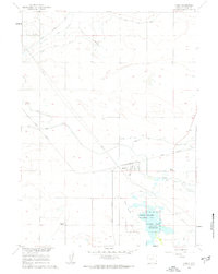 1960 Yoder1962 Print · USGSSoutheast Wyoming’s high plains and irrigation networks are on full display during the early 1960s. Genealogists and local historians can trace the Union Pacific rail corridor through Yoder and locate the sprawling Greasewood Ranch and Goshen Hole (Springer) Reservoir.3 unique versions available
 - 1990 Map of Yoder, 1995 Print
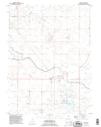 1990 Yoder1995 Print · USGSIn the 1990s, the Wyoming high plains around Goshen County were defined by a complex irrigation network and cattle ranching. Researchers can trace the layout of the Yoder settlement, locate the Greasewood Ranch, and follow the path of the Fort Laramie Canal.
End of results
Showing maps 1-4 of 4
Top cities near Silver Tip
- Torrington historical maps
- Lingle historical maps
- Lyman historical maps
- Yoder historical maps
- Henry historical maps
Frequently asked questions
- What are the different types of historical maps available for Silver Tip?
- What is the oldest map of Silver Tip?
- Where can I purchase historical maps of Silver Tip for my home or office?
- Where can I download high-res historical maps of Silver Tip?
- Are there historical topographic maps available for Silver Tip?
- Is there historical aerial imagery available for Silver Tip?
- Where are historical maps of Silver Tip sourced from?