Old Maps of Owl Creek, Wyoming for Metal Detecting
Plan your next treasure hunt with 11 historic maps of Owl Creek. Find old homesites, ghost towns, trails, and gathering spots that may be lost to time — perfect for identifying promising metal detecting locations.
- Locate forgotten sites: Uncover places like long-lost settlements, abandoned rail lines, or gathering spots.
- Plan better hunts: Use map overlays combined with LiDAR or satellite views to narrow in on historically rich areas.
- Made for detectorists: Thousands of hobbyists use these maps to discover relics, coins, and hidden history.
Use these historic maps to boost your research and find new opportunities beneath the surface of Owl Creek.
Owl Creek, WY maps
(11)- 1913 Map of Grass Creek Basin, 1962 Print
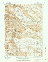 1913 Grass Creek Basin1962 Print · USGSHot Springs County ranching life is preserved here during the early twentieth century, showing a remote landscape of isolated family homesteads and vital water sources. Genealogists and historians can locate early properties like Wales Ranch and Kemp Ranch, or trace the rugged geography of the Putney Mine and Grass Creek Basin.2 unique versions available
 - 1915 Map of Grass Creek Basin
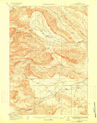 1915 Grass Creek Basin1915 Print · USGSHot Springs County homesteads and early Wyoming resource extraction are documented here in the years before the Great War. Genealogists and historians can locate family-named landmarks like Littlejohn Ranch, Putney Mine, and Wagonhound Spring.3 unique versions available
 - 1955 Map of Thermopolis, 1969 Print
 1955 Thermopolis1969 Print · USGSMid-century Wyoming comes alive in this survey of the Wind River basin and the high Absaroka peaks. Trace the roots of oil and water development through the Hamilton Dome Oil Field and the Boysen Reservoir, or locate local landmarks like the Wyoming Industrial Institute and St. Stephens.2 unique versions available
 - 1958 Map of Thermopolis
 1958 Thermopolis1958 Print · USGSThe Bighorn Basin and Wind River Reservation are shown here in the late fifties, during a period of significant petroleum and agricultural growth. Genealogists and historians can trace rail-towns like Gebo, energy hubs like the Hamilton Dome Oil Field, and the layout of Fort Washakie.2 unique versions available
 - 1962 Map of Thermopolis
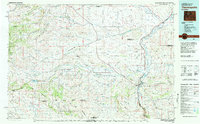
 1962 Thermopolis1962 Print · USGSThe Wind River and Bighorn basins are meticulously mapped in the early sixties, showing the vital irrigation and rail networks of the era. Genealogists and historians can locate specific landmarks like the Duncan Ranch School, the Wyoming Industrial Institute, and the Hamilton Dome oil field.
 - 1981 Map of Thermopolis, 1982 Print
 1981 Thermopolis1982 Print · USGSCentral Wyoming in the early eighties shows a landscape of geothermal wonders and energy extraction. Trace the legacy of early settlements and industry near Hot Springs State Park, the rail lines of the Burlington Northern, and outposts like Gebo and Hamilton Dome.
 - 1985 Map of Hamilton Dome
 1985 Hamilton Dome1985 Print · USGSThe energy frontier of central Wyoming comes into focus in the mid-1980s, centered on the Hamilton Dome oil operations. Researchers can trace extraction infrastructure across the Wind River Indian Reservation and locate local landmarks like Lake Charlie.
 - 2012 Map of Hamilton Dome, 2012 Print
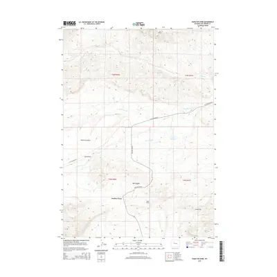
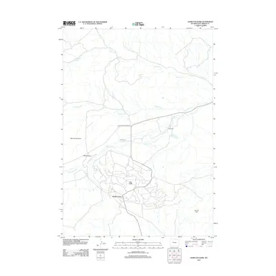 2012 Hamilton Dome2012 Print · USGSCovers Owl Creek, including Hamilton Dome, Hot Springs County, and other nearby areas
 - 2015 Map of Hamilton Dome, 2015 Print
 2015 Hamilton Dome2015 Print · USGSCovers Owl Creek, including Hamilton Dome, Hot Springs County, and other nearby areas
 - 2017 Map of Hamilton Dome, 2017 Print
 2017 Hamilton Dome2017 Print · USGSCovers Owl Creek, including Hamilton Dome, Hot Springs County, and other nearby areas
 - 2021 Map of Hamilton Dome, 2021 Print
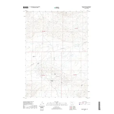
 2021 Hamilton Dome2021 Print · USGSHot Springs County at the start of the 2020s reveals a high-desert landscape of ranch roads and remote landmarks. Trace the local terrain from the Hamilton Dome settlement to Legend Rocks and the waters of Wales Reservoir.
End of results
Showing maps 1-11 of 11
Frequently asked questions
- What are the different types of historical maps available for Owl Creek?
- What is the oldest map of Owl Creek?
- Where can I purchase historical maps of Owl Creek for my home or office?
- Where can I download high-res historical maps of Owl Creek?
- Are there historical topographic maps available for Owl Creek?
- Is there historical aerial imagery available for Owl Creek?
- Where are historical maps of Owl Creek sourced from?