1960s Maps of Antelope Hills, Wyoming
Explore 2 historic maps of Antelope Hills from the 1960s. These maps offer a rare glimpse into what life looked like during the 1960s — showing old roads, neighborhoods, homes, and landmarks that have changed or disappeared over time.
Whether you're researching your family's past, planning a metal detecting trip, or studying how Antelope Hills's landscape evolved across the 1960s, these high-resolution maps are a powerful tool for exploring the history of this region.
- Focus on a specific era: All maps on this page are from the 1960s, giving you a focused view of this time period.
- See what’s changed: Compare century-old streets, trails, and buildings to today's modern landscape using overlays and satellite layers.
- Research with precision: Use these maps for genealogy, historical research, land use analysis, or educational projects.
- View, download, or print: Maps are fully viewable online in high resolution, and can be downloaded or printed for your own records.
Start exploring Antelope Hills's history through authentic maps from the 1960s. This is your window into the past.
Antelope Hills, WY maps
(2)- 1962 Map of Arminto
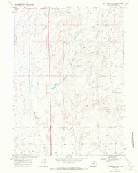
 1962 Arminto1962 Print · USGSCentral Wyoming in the early sixties reveals a landscape shaped by the Chicago and North Western railroad and early energy development. Trace the history of the region through remote outposts like Arminto, the US Naval Petroleum Reserve, and the geologic landmark at Hells Half Acre.
 - 1968 Map of Mc Pherson Draw, 1972 Print
 1968 Mc Pherson Draw1972 Print · USGSNatrona County in the late sixties reveals a high-plains landscape defined by the growing Wyoming energy sector. Researchers can trace the industrial footprint of the era through sites like Seventeenmile Well, Mc Pherson Draw, and various Oil Wells.2 unique versions available
End of results
Showing maps 1-2 of 2
Top cities near Antelope Hills
- Casper historical maps
- Mills historical maps
- Bar Nunn historical maps
- Evansville historical maps
- Vista West historical maps
- Hartrandt historical maps
See more
Frequently asked questions
- What are the different types of historical maps available for Antelope Hills?
- What is the oldest map of Antelope Hills?
- Where can I purchase historical maps of Antelope Hills for my home or office?
- Where can I download high-res historical maps of Antelope Hills?
- Are there historical topographic maps available for Antelope Hills?
- Is there historical aerial imagery available for Antelope Hills?
- Where are historical maps of Antelope Hills sourced from?