Old Maps of Osborne Place, Wyoming for Hiking & Exploration
Hike through history with 6 historic maps of Osborne Place. Explore old trails, ghost towns, and forgotten backroads — perfect for outdoor adventurers and local explorers.
- Rediscover forgotten places: Map out old mining camps, roads, and footpaths that no longer exist on modern maps.
- Layer with modern tools: Combine with LiDAR or satellite views to plan hikes through historical terrain.
- Made for exploration: Popular among hikers, overlanders, and local history lovers.
Use these maps to find adventure and explore the hidden past of Osborne Place.
Osborne Place, WY maps
(6)- 1952 Map of Arminto SW, 1953 Print
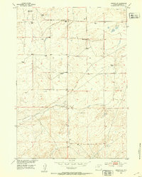 1952 Arminto SW1953 Print · USGSIn the early fifties, the high plains of Natrona County were home to remote ranching operations and isolated country schools. Genealogists and historians can trace family-named sites such as Neff Ranch and O'Donnel Ranch or the location of the Divide School.2 unique versions available
 - 1955 Map of Arminto, 1976 Print
 1955 Arminto1976 Print · USGSCentral Wyoming at the mid-century shows a landscape of energy reserves and high-plains ranching. Genealogists and historians can trace the Burlington Northern line through Lost Cabin and the famed Teapot Dome Naval Petroleum Reserve No 3.2 unique versions available
 - 1958 Map of Arminto
 1958 Arminto1958 Print · USGSCentral Wyoming in the late fifties was a landscape of high-plains energy and remote rail outposts. Researchers can trace the Chicago Burlington and Quincy railroad through towns like Arminto and Waltman or locate landmarks like Teapot Rock.
 - 1962 Map of Arminto
 1962 Arminto1962 Print · USGSCentral Wyoming in the early sixties reveals a landscape shaped by the Chicago and North Western railroad and early energy development. Trace the history of the region through remote outposts like Arminto, the US Naval Petroleum Reserve, and the geologic landmark at Hells Half Acre.
 - 1982 Map of Lysite
 1982 Lysite1982 Print · USGSCentral Wyoming's high plains and mountain foothills are captured here in the early 1980s, centered on the ranching and rail outposts of Natrona and Fremont Counties. Genealogists and historians can trace the paths of the Burlington Northern and the Old Railroad Grade through Lysite, Lost Cabin, and Arminto.
 - 2021 Map of Arminto SW, 2021 Print
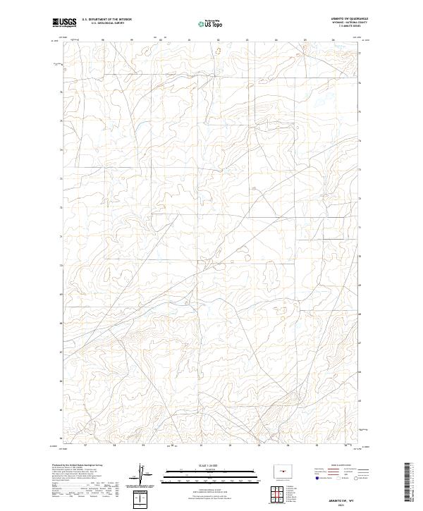 2021 Arminto SW2021 Print · USGSNatrona County's high plains are documented here in the early 2020s, showing a landscape defined by the Public Land Survey System. Researchers can trace the path of Poison Cr and examine the grid of T36N R89W and T35N R88W.
End of results
Showing maps 1-6 of 6
Frequently asked questions
- What are the different types of historical maps available for Osborne Place?
- What is the oldest map of Osborne Place?
- Where can I purchase historical maps of Osborne Place for my home or office?
- Where can I download high-res historical maps of Osborne Place?
- Are there historical topographic maps available for Osborne Place?
- Is there historical aerial imagery available for Osborne Place?
- Where are historical maps of Osborne Place sourced from?