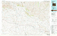
1982 Map of Lysite
USGS Topo · Published 1982About this map
Badwater Creek and Poison Creek carve through this central Wyoming landscape at the junction of Fremont and Natrona Counties. Small ranching and rail settlements like Lysite and Lost Cabin serve as the primary hubs in an area defined by the high ridges of Copper Mountain and the southern edge of the Bighorn Mountains. The map reveals a transition in transportation history, following the active Burlington Northern line alongside remnants of an Old Railroad Grade that once connected these isolated outposts.
Find a feature on this map
81 named features on this map. Tap any name to fly to it.
Don’t see what you’re looking for? This feature index may not catch every label — zoom into the map to look around manually.
Map Details
Editions of this 1982 Lysite Map
This is the sole edition of this map. No revisions or reprints were ever made.
Other maps of this area

1951 · Fuller Reservoir
USGS Topo · 1:24,000

1951 · Birdseye Pass
USGS Topo · 1:24,000

1951 · Bonneville
USGS Topo · 1:24,000

1951 · Shoshoni
USGS Topo · 1:24,000

1951 · Square Top Butte
USGS Topo · 1:24,000

1952 · Seventy-one Reservoir
USGS Topo · 1:24,000

1952 · Squaw Butte NE
USGS Topo · 1:24,000

1952 · Squaw Butte
USGS Topo · 1:24,000

1952 · Ocla Draw
USGS Topo · 1:24,000

1952 · Deadman Butte
USGS Topo · 1:24,000