
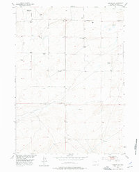
1952 Map of Arminto SW
USGS Topo · Published 1953About this map
Isolated ranching outposts and high-plains educational landmarks dot this 1952 topographic study of Natrona County. The landscape is defined by the ephemeral Poison Creek and a network of windmills critical for livestock in this arid environment. Evidence of a changing rural structure is visible through several sites already noted as unoccupied by the early 1950s, including the Poison Creek School and the Osborne Place. Family-named landholdings like the Neff Ranch and O'Donnel Ranch anchor the local geography, while the Divide School served as a central point for the surrounding homesteads. This survey was conducted as part of the Department of the Interior's Missouri River Basin development program, documenting the terrain at a scale of 1:24,000 to assist in regional water and land management planning during the mid-century period.
Find a feature on this map
12 named features on this map. Tap any name to fly to it.
Don’t see what you’re looking for? This feature index may not catch every label — zoom into the map to look around manually.
Map Details
Editions of this 1952 Arminto SW Map
2 editions found
Other maps of this area

1952 · Arminto
USGS Topo · 1:24,000

1952 · Madden
USGS Topo · 1:24,000

1952 · Arminto NW
USGS Topo · 1:24,000

1952 · Moneta SE
USGS Topo · 1:24,000

1952 · Miles Ranch
USGS Topo · 1:24,000

1952 · Hiland
USGS Topo · 1:24,000

1952 · Ervay Basin
USGS Topo · 1:24,000

1955 · Arminto
USGS Topo · 1:250,000

1955 · Casper
USGS Topo · 1:250,000

1957 · Miles Ranch
USGS Topo · 1:24,000