
1957 Map of Miles Ranch
USGS Topo · Published 1958About this map
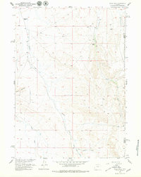
Miles Ranch and the Thompson Ranch serve as primary anchors in this mid-century depiction of the high Wyoming desert landscape. The terrain is defined by the unique formations of Castle Gardens, where the topography creates a distinct island of relief amidst the surrounding drainages. Water management and seasonal flows are central to the settlement pattern here, with Canyon Creek and its tributaries, West Canyon Creek and East Canyon Creek, carving deep paths through the high country. The map also delineates the jurisdictional boundary between Fremont Co and Natrona Co, providing a clear record of land division in an area dominated by large livestock operations and rugged open range. This document captures the remote character of the Missouri River Basin development program, recording the placement of remote ranch outposts and the winding path of Deer Creek before more modern infrastructure altered the reach of these isolated homesteads.
Find a feature on this map
9 named features on this map. Tap any name to fly to it.
Don’t see what you’re looking for? This feature index may not catch every label — zoom into the map to look around manually.
Map Details
Editions of this 1957 Miles Ranch Map
3 editions found
Other maps of this area

1952 · Seventy-one Reservoir
USGS Topo · 1:24,000

1952 · Ervay Basin SW
USGS Topo · 1:24,000

1952 · Arminto SW
USGS Topo · 1:24,000

1952 · Love Ranch
USGS Topo · 1:24,000

1952 · Gas Hills
USGS Topo · 1:24,000

1952 · Puddle Springs
USGS Topo · 1:24,000

1952 · Moneta SE
USGS Topo · 1:24,000

1952 · Miles Ranch
USGS Topo · 1:24,000

1952 · Ervay Basin
USGS Topo · 1:24,000

1955 · Arminto
USGS Topo · 1:250,000