
1952 Map of Ervay Basin SW
USGS Topo · Published 1953About this map
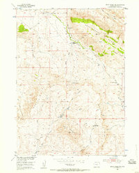
The high-desert terrain of the Rattlesnake Range and Beaver Rim dominates this mid-century survey of Wyoming's Natrona County. Settled life in this arid landscape is marked by the presence of isolated water sources and long-distance infrastructure, including an early Pipe Line and the Asbell Road. The map provides a look at the footprint of early ranching and homesteading efforts, recording the Holiday Homestead (Aband) and the Aspell Homestead Site.
Find a feature on this map
25 named features on this map. Tap any name to fly to it.
Don’t see what you’re looking for? This feature index may not catch every label — zoom into the map to look around manually.
Map Details
Editions of this 1952 Ervay Basin SW Map
3 editions found
Other maps of this area

1952 · Gas Hills
USGS Topo · 1:24,000

1952 · Miles Ranch
USGS Topo · 1:24,000

1952 · Ervay Basin
USGS Topo · 1:24,000

1952 · Mc Intosh Meadows
USGS Topo · 1:24,000

1955 · Casper
USGS Topo · 1:250,000

1957 · Miles Ranch
USGS Topo · 1:24,000

1958 · Casper
USGS Topo · 1:250,000
1958 · Gas Hills
USGS Topo · 1:24,000
1959 · Mc Rae Gap
USGS Topo · 1:24,000

1959 · Blackjack Ranch
USGS Topo · 1:24,000