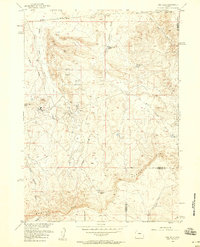
1958 Map of Gas Hills
USGS Topo · Published 1959About this map
The Gas Hills and the striking ascent of the Beaver Rim define this central Wyoming landscape during the mid-century uranium boom. This 1958 revision documents the industrial footprint of the era, centered on the Lucky Mac Uranium Mill and the adjacent residential Lucky Mac Camp. The terrain is characterized by a series of high basins and drainage draws, including Dutton Basin and Fraser Draw, which are marked by numerous oil wells and extensive mine dumps. Water management in this arid environment is evident through a network of small catchments such as Medicine Springs Reservoir and Canyon Creek Reservoir. Straddling the border of Fremont and Natrona Counties, the map reveals a remote working landscape where mining infrastructure and specialized landing strips coexist with traditional landmarks like Sarcophagus Butte.
Find a feature on this map
25 named features on this map. Tap any name to fly to it.
Don’t see what you’re looking for? This feature index may not catch every label — zoom into the map to look around manually.
Map Details
Editions of this 1958 Gas Hills Map
3 editions found
Other maps of this area

1952 · Ervay Basin SW
USGS Topo · 1:24,000

1952 · Love Ranch
USGS Topo · 1:24,000

1952 · Gas Hills
USGS Topo · 1:24,000

1952 · Puddle Springs
USGS Topo · 1:24,000

1952 · Miles Ranch
USGS Topo · 1:24,000

1952 · Coyote Springs
USGS Topo · 1:24,000

1952 · Ervay Basin
USGS Topo · 1:24,000

1952 · Mc Intosh Meadows
USGS Topo · 1:24,000

1955 · Casper
USGS Topo · 1:250,000

1957 · Miles Ranch
USGS Topo · 1:24,000