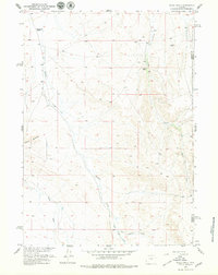
1957 Map of Miles Ranch
USGS Topo · Published 1979About this map
Miles Ranch and Thompson Ranch anchor this mid-century look at the high desert terrain straddling the border of Fremont and Natrona Counties. The landscape is defined by a network of seasonal drainages, including the bifurcating West Canyon Creek and East Canyon Creek, which navigate through complex topographic forms like Castle Gardens. This 1957 survey was conducted as part of the Department of the Interior's Missouri River Basin development program, illustrating the era's focus on water resource management and land use in the Wyoming interior. Surveyors noted practical infrastructure such as a Corral and various Wells, reflecting the sheep or cattle ranching operations that utilized the sparse water of Deer Creek and Fraser Draw. The map provides specific elevation data through numerous benchmarks and the VABM Ants 6301 station, essential for local land navigation and historical property research.
Find a feature on this map
17 named features on this map. Tap any name to fly to it.
Don’t see what you’re looking for? This feature index may not catch every label — zoom into the map to look around manually.
Map Details
Editions of this 1957 Miles Ranch Map
3 editions found

Other maps of this area

1952 · Seventy-one Reservoir
USGS Topo · 1:24,000

1952 · Ervay Basin SW
USGS Topo · 1:24,000

1952 · Arminto SW
USGS Topo · 1:24,000

1952 · Love Ranch
USGS Topo · 1:24,000

1952 · Gas Hills
USGS Topo · 1:24,000

1952 · Puddle Springs
USGS Topo · 1:24,000

1952 · Moneta SE
USGS Topo · 1:24,000

1952 · Miles Ranch
USGS Topo · 1:24,000

1952 · Ervay Basin
USGS Topo · 1:24,000

1955 · Arminto
USGS Topo · 1:250,000