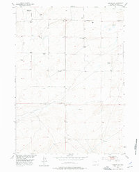
1952 Map of Arminto SW
USGS Topo · Published 1976About this map
Neff Ranch and O'Donnel Ranch anchor this landscape in Central Wyoming during the early 1950s, a region defined by high-altitude grazing and sparse, resilient settlements. The presence of several Sheep Corrals and scattered Windmills underscores the dominance of livestock ranching in this portion of Natrona County. Educational and social centers appear in transition on this survey, which captures both active and inactive sites like the Divide School and the Poison Creek School (Aband). Water remains the most critical resource for the area, with the drainage of Poison Creek cutting through the northern reaches. The designation of the Osborne Place (Aband) provides a specific data point for genealogists and local historians tracking the movement of early homesteading families as ranching operations consolidated or moved during the mid-century.
Find a feature on this map
8 named features on this map. Tap any name to fly to it.
Don’t see what you’re looking for? This feature index may not catch every label — zoom into the map to look around manually.
Map Details
Editions of this 1952 Arminto SW Map
2 editions found
Other maps of this area

1952 · Arminto
USGS Topo · 1:24,000

1952 · Arminto SW
USGS Topo · 1:24,000

1952 · Madden
USGS Topo · 1:24,000

1952 · Arminto NW
USGS Topo · 1:24,000

1952 · Moneta SE
USGS Topo · 1:24,000

1952 · Miles Ranch
USGS Topo · 1:24,000

1952 · Hiland
USGS Topo · 1:24,000

1952 · Ervay Basin
USGS Topo · 1:24,000

1955 · Arminto
USGS Topo · 1:250,000

1955 · Casper
USGS Topo · 1:250,000