
1952 Map of Arminto
USGS Topo · Published 1953About this map
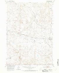
Arminto stands as a rail-side settlement along the Chicago Burlington and Quincy railroad, serving as a focal point for this high-plains landscape in the early 1950s. The map illustrates a ranching and transport economy where isolated outposts like Carlson Ranch and landmarks such as a Water Tank and a small Cem reflect the sparse but vital human presence in Natrona County. Water management is central to life here, evidenced by the E-K Ditch and several small catchments like Garrison Reservoir and Jackpot Reservoir.
Find a feature on this map
20 named features on this map. Tap any name to fly to it.
Don’t see what you’re looking for? This feature index may not catch every label — zoom into the map to look around manually.
Map Details
Editions of this 1952 Arminto Map
3 editions found
Other maps of this area

1952 · Deadman Butte
USGS Topo · 1:24,000

1952 · Badwater
USGS Topo · 1:24,000

1952 · Arminto SW
USGS Topo · 1:24,000

1952 · Arminto NW
USGS Topo · 1:24,000

1952 · Waltman NW
USGS Topo · 1:24,000

1952 · Waltman
USGS Topo · 1:24,000

1952 · Hiland
USGS Topo · 1:24,000

1952 · Badwater SE
USGS Topo · 1:24,000

1955 · Arminto
USGS Topo · 1:250,000

1958 · Arminto
USGS Topo · 1:250,000