1960s Maps of Kamms Corner, Wyoming
Explore 2 historic maps of Kamms Corner from the 1960s. These maps offer a rare glimpse into what life looked like during the 1960s — showing old roads, neighborhoods, homes, and landmarks that have changed or disappeared over time.
Whether you're researching your family's past, planning a metal detecting trip, or studying how Kamms Corner's landscape evolved across the 1960s, these high-resolution maps are a powerful tool for exploring the history of this region.
- Focus on a specific era: All maps on this page are from the 1960s, giving you a focused view of this time period.
- See what’s changed: Compare century-old streets, trails, and buildings to today's modern landscape using overlays and satellite layers.
- Research with precision: Use these maps for genealogy, historical research, land use analysis, or educational projects.
- View, download, or print: Maps are fully viewable online in high resolution, and can be downloaded or printed for your own records.
Start exploring Kamms Corner's history through authentic maps from the 1960s. This is your window into the past.
Kamms Corner, WY maps
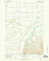
(2)- 1962 Map of Cody
 1962 Cody1962 Print · USGSBig Horn Basin energy and agriculture define this mid-century look at Wyoming’s northern frontier. Local historians can trace the irrigation and rail networks connecting Cody and Powell to major energy sites like the Oregon Basin Oil Field.
 - 1966 Map of Vocation, 1970 Print
 1966 Vocation1970 Print · USGSPark County irrigation and transport networks are captured here in the mid-1960s as water transformed the high plains. Trace the legacy of frontier travel at the Eaglenest (Historical Stage Station) and the industrial footprint of the Willwood Dam and Corbett Tunnel.2 unique versions available
End of results
Showing maps 1-2 of 2
Top cities near Kamms Corner
Frequently asked questions
- What are the different types of historical maps available for Kamms Corner?
- What is the oldest map of Kamms Corner?
- Where can I purchase historical maps of Kamms Corner for my home or office?
- Where can I download high-res historical maps of Kamms Corner?
- Are there historical topographic maps available for Kamms Corner?
- Is there historical aerial imagery available for Kamms Corner?
- Where are historical maps of Kamms Corner sourced from?