Old Maps of Pahaska Tepee, Wyoming for Hiking & Exploration
Hike through history with 10 historic maps of Pahaska Tepee. Explore old trails, ghost towns, and forgotten backroads — perfect for outdoor adventurers and local explorers.
- Rediscover forgotten places: Map out old mining camps, roads, and footpaths that no longer exist on modern maps.
- Layer with modern tools: Combine with LiDAR or satellite views to plan hikes through historical terrain.
- Made for exploration: Popular among hikers, overlanders, and local history lovers.
Use these maps to find adventure and explore the hidden past of Pahaska Tepee.
Pahaska Tepee, WY maps
(10)- 1896 Map of Crandall Creek
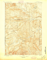 1896 Crandall Creek1896 Print · USGSThe high peaks of the Absaroka Range and the early Yellowstone frontier are captured in the 1890s. Trace the beginnings of the Sunlight Mining Region and identify landmarks like Beartooth Butte and Pilot Peak.
 - 1899 Map of Crandall
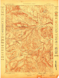 1899 Crandall1899 Print · USGSThe Absaroka mountains and northern park lands are captured here during the frontier mining era of the 1890s. Researchers can trace early claims in the Sunlight Mining Region and identify landmarks like Pilot Peak and Beartooth Butte.4 unique versions available
 - 1955 Map of Cody, 1969 Print
 1955 Cody1969 Print · USGSThe Bighorn Basin and Absaroka Range meet in the mid-fifties, capturing a landscape defined by mountain wilderness and burgeoning oil fields. Trace family roots in Cody or Meeteetse, and locate industrial landmarks like the Elk Basin Oil and Gas Field and the Chicago Burlington and Quincy RR.2 unique versions available
 - 1956 Map of Sunlight Peak, 1958 Print
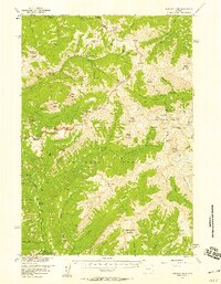 1956 Sunlight Peak1958 Print · USGSThe Absaroka wilderness comes alive in the mid-1950s at the intersection of Yellowstone and the Shoshone National Forest. Local historians can trace early mountain life through the Sunlight Mining Region, the Camp Monaco Historical Marker, and Pahaska Tepee.4 unique versions available
 - 1958 Map of Cody
 1958 Cody1958 Print · USGSNorthwestern Wyoming at the peak of the mid-century energy and ranching boom shows a land of high peaks and oil basins. Researchers can trace the Chicago Burlington and Quincy rail lines through Greybull or locate the sprawling Elk Basin Oil and Gas Field.
 - 1962 Map of Cody
 1962 Cody1962 Print · USGSBig Horn Basin energy and agriculture define this mid-century look at Wyoming’s northern frontier. Local historians can trace the irrigation and rail networks connecting Cody and Powell to major energy sites like the Oregon Basin Oil Field.
 - 1980 Map of Cody, 1982 Print
 1980 Cody1982 Print · USGSThe Cody region in the early 1980s reveals a rugged wilderness of the Shoshone National Forest meeting the plains. Researchers can trace the Burlington Northern rail line and locate landmarks like Painter Mine and Buffalo Bill Reservoir.3 unique versions available
 - 1989 Map of Pahaska Tepee
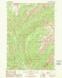 1989 Pahaska Tepee1989 Print · USGSThe Absaroka Range and the Shoshone River corridor come to life in this late 1980s survey of the Wyoming backcountry. Researchers can locate the historical Camp Monaco Site and trace trails past Red Ridge or the Pahaska Tepee Campground.
 - 1991 Map of Pahaska Tepee, 1997 Print
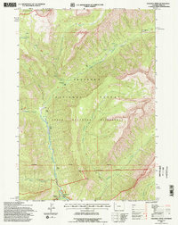 1991 Pahaska Tepee1997 Print · USGSThe area surrounding Pahaska Tepee and the eastern edge of Yellowstone National Park is captured here in the early nineties. Researchers can locate the historical Camp Monaco (Site) and trace the high-country drainages of Jones Creek and Middle Creek.2 unique versions available
 - 2021 Map of Pahaska Tepee, 2021 Print
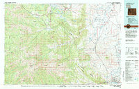
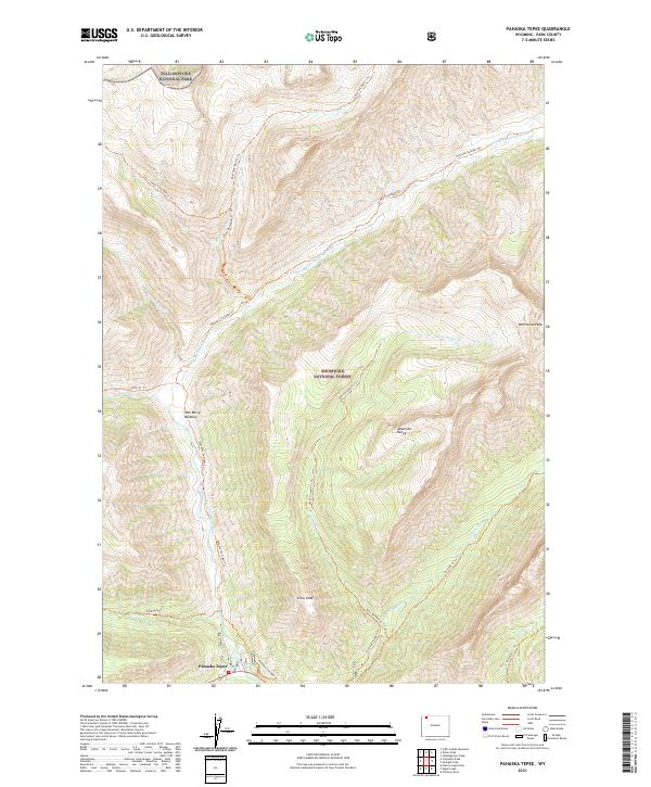 2021 Pahaska Tepee2021 Print · USGSThe Absaroka mountains meet the eastern edge of Yellowstone in this recent survey of the Shoshone National Forest. Hikers and historians can trace routes through the Absaroka Range via the Pahaska Sunlight Trl or locate the Sam Berry Meadow.
End of results
Showing maps 1-10 of 10
Frequently asked questions
- What are the different types of historical maps available for Pahaska Tepee?
- What is the oldest map of Pahaska Tepee?
- Where can I purchase historical maps of Pahaska Tepee for my home or office?
- Where can I download high-res historical maps of Pahaska Tepee?
- Are there historical topographic maps available for Pahaska Tepee?
- Is there historical aerial imagery available for Pahaska Tepee?
- Where are historical maps of Pahaska Tepee sourced from?