
1899 Map of Crandall
USGS Topo · Published 1899About this map
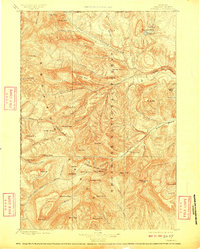
Sunlight Mining Region occupies the central drainage of this late 19th-century landscape, where prospectors sought minerals along the high peaks of the Absaroka Range. The survey, conducted by Frank Tweedy under the direction of Charles D. Walcott, captures the transition of this territory from wild frontier to managed public land within the Yellowstone Park Forest Reservation. Evidence of glacial action and deep erosion is visible in the steep descent of the Clark Fork Canyon and the broad Sunlight Basin. Notable landmarks such as Pilot Peak and Index Peak stand at the Montana border, while the western edge of the sheet identifies the early boundaries of Yellowstone National Park. Numerous named peaks like Pollux Peak, Castor Peak, and Saddle Mtn. illustrate the complex topography that early geographers mapped before the turn of the century.
Find a feature on this map
80 named features on this map. Tap any name to fly to it.
Don’t see what you’re looking for? This feature index may not catch every label — zoom into the map to look around manually.
Map Details
Editions of this 1899 Crandall Map
4 editions found
Other maps of this area

1885 · Lake
USGS Topo · 1:125,000

1886 · Canyon
USGS Topo · 1:125,000

1891 · Livingston
USGS Topo · 1:250,000

1893 · Livingston
USGS Topo · 1:250,000

1893 · Ishawooa
USGS Topo · 1:125,000

1895 · Ishawooa
USGS Topo · 1:125,000

1895 · Canyon
USGS Topo · 1:125,000

1895 · Lake
USGS Topo · 1:125,000

1896 · Lake
USGS Topo · 1:125,000

1896 · Canyon
USGS Topo · 1:125,000