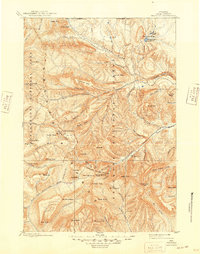
1899 Map of Crandall
USGS Topo · Published 1949About this map
The Sunlight Mining Region anchors the high-country geography of this 1890s survey, a time when prospecting and early resource extraction were shaping the Absaroka Range. Positioned at the intersection of the Shoshone National Forest and the Yellowstone National Park boundary, the landscape is defined by massive glacial and volcanic features like Hurricane Mesa and the deep incision of Clarks Fork Canyon.
Find a feature on this map
82 named features on this map. Tap any name to fly to it.
Don’t see what you’re looking for? This feature index may not catch every label — zoom into the map to look around manually.
Map Details
Editions of this 1899 Crandall Map
4 editions found

Other maps of this area

1885 · Lake
USGS Topo · 1:125,000

1886 · Canyon
USGS Topo · 1:125,000

1891 · Livingston
USGS Topo · 1:250,000

1893 · Livingston
USGS Topo · 1:250,000

1893 · Ishawooa
USGS Topo · 1:125,000

1895 · Ishawooa
USGS Topo · 1:125,000

1895 · Canyon
USGS Topo · 1:125,000

1895 · Lake
USGS Topo · 1:125,000

1896 · Lake
USGS Topo · 1:125,000

1896 · Canyon
USGS Topo · 1:125,000