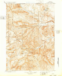
1899 Map of Crandall
USGS Topo · Published 1932About this map
The Sunlight Mining Region anchors the southeastern reaches of this 1890s reconnaissance, a time when prospectors were actively surveying the high basins for mineral wealth. Situated between the eastern edge of Yellowstone National Park and the deep gorge of Clark Fork Canyon, the landscape is defined by the high-altitude drainage systems of the Clark Fork and the Sunlight Creek. Named peaks like Hoodoo Peak, Index Peak, and the distinctive Beartooth Butte provide a vertical framework for the region's early geography.
Find a feature on this map
86 named features on this map. Tap any name to fly to it.
Don’t see what you’re looking for? This feature index may not catch every label — zoom into the map to look around manually.
Map Details
Editions of this 1899 Crandall Map
4 editions found

Other maps of this area

1885 · Lake
USGS Topo · 1:125,000

1886 · Canyon
USGS Topo · 1:125,000

1891 · Livingston
USGS Topo · 1:250,000

1893 · Livingston
USGS Topo · 1:250,000

1893 · Ishawooa
USGS Topo · 1:125,000

1895 · Ishawooa
USGS Topo · 1:125,000

1895 · Canyon
USGS Topo · 1:125,000

1895 · Lake
USGS Topo · 1:125,000

1896 · Lake
USGS Topo · 1:125,000

1896 · Canyon
USGS Topo · 1:125,000