1960s Maps of Sheridan, Wyoming
Explore 4 historic maps of Sheridan from the 1960s. These maps offer a rare glimpse into what life looked like during the 1960s — showing old roads, neighborhoods, homes, and landmarks that have changed or disappeared over time.
Whether you're researching your family's past, planning a metal detecting trip, or studying how Sheridan's landscape evolved across the 1960s, these high-resolution maps are a powerful tool for exploring the history of this region.
- Focus on a specific era: All maps on this page are from the 1960s, giving you a focused view of this time period.
- See what’s changed: Compare century-old streets, trails, and buildings to today's modern landscape using overlays and satellite layers.
- Research with precision: Use these maps for genealogy, historical research, land use analysis, or educational projects.
- View, download, or print: Maps are fully viewable online in high resolution, and can be downloaded or printed for your own records.
Start exploring Sheridan's history through authentic maps from the 1960s. This is your window into the past.
Sheridan, WY maps
(4)- 1962 Map of Sheridan
 1962 Sheridan1962 Print · USGSThe Big Horn Mountains and Powder River country are captured here in the early sixties as energy production and ranching shaped northern Wyoming. Researchers can locate specific sites like the Kleenburn Coal Tipple, Eaton Bros Ranch, and the Fort McKenzie Veteran Hospital.
 - 1964 Map of Hultz Draw, 1968 Print
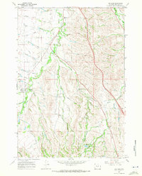
 1964 Hultz Draw1968 Print · USGSSheridan County's high-plains landscape was defined by its intricate water systems and rural outposts in the 1960s. Genealogists and researchers can trace local landmarks like the Big Goose Sch, the Alliance Ditch, and the namesake Hultz Draw.3 unique versions available
 - 1967 Map of Big Horn, 1972 Print
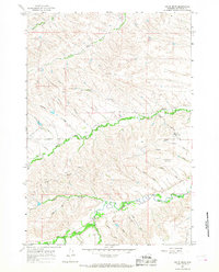
 1967 Big Horn1972 Print · USGSSheridan County ranching and irrigation are captured here in the late sixties, centered on the community of Big Horn. Researchers can trace early infrastructure and land use through the Woodland Park Sch, the State Bird Farm, and numerous historic canals like Gerdel Ditch.3 unique versions available
 - 1968 Map of Sheridan, 1972 Print
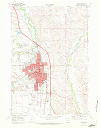 1968 Sheridan1972 Print · USGSSheridan enters the late sixties as a vital regional center shaped by the Burlington Northern railroad and Goose Creek. Researchers can locate the Sheridan Inn, the Veterans Adm Hospital, and family sites near Mt Hope Cem.3 unique versions available
End of results
Showing maps 1-4 of 4
Top cities near Sheridan
Top neighborhoods of Sheridan
Frequently asked questions
- What are the different types of historical maps available for Sheridan?
- What is the oldest map of Sheridan?
- Where can I purchase historical maps of Sheridan for my home or office?
- Where can I download high-res historical maps of Sheridan?
- Are there historical topographic maps available for Sheridan?
- Is there historical aerial imagery available for Sheridan?
- Where are historical maps of Sheridan sourced from?