1900s (20th Century) Maps of Merna, Wyoming
Explore 7 historic maps of Merna from the 1900s (20th Century). These maps offer a rare glimpse into what life looked like during the 1900s — showing old roads, neighborhoods, homes, and landmarks that have changed or disappeared over time.
Whether you're researching your family's past, planning a metal detecting trip, or studying how Merna's landscape evolved across the 1900s, these high-resolution maps are a powerful tool for exploring the history of this region.
- Focus on a specific era: All maps on this page are from the 1900s, giving you a focused view of this time period.
- See what’s changed: Compare century-old streets, trails, and buildings to today's modern landscape using overlays and satellite layers.
- Research with precision: Use these maps for genealogy, historical research, land use analysis, or educational projects.
- View, download, or print: Maps are fully viewable online in high resolution, and can be downloaded or printed for your own records.
Start exploring Merna's history through authentic maps from the 1900s. This is your window into the past.
Merna, WY maps
(7)- 1939 Map of Big Piney, 1957 Print
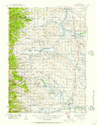 1939 Big Piney1957 Print · USGSSublette County ranching country and the Green River valley are shown here just before the war. You can trace the historic Lander Trail and locate early sites like Site of Old Ft Bonneville and Halfway.
 - 1942 Map of Big Piney
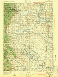 1942 Big Piney1942 Print · USGSSublette County ranching and frontier history are captured here in the early 1940s, just as the region's irrigation and land management systems were maturing. Genealogists can locate family names and remote landmarks like the Bronx Sch, the Site of Old Ft Bonneville, and the State Fish Hatchery.
 - 1955 Map of Preston, 1968 Print
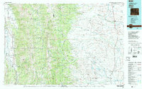
 1955 Preston1968 Print · USGSSoutheast Idaho and western Wyoming are shown in detail during the mid-fifties, from the high Bear River Range to the Green River Basin. Genealogists and collectors can trace the Union Pacific RR through historic towns like Preston, Montpelier, and Afton.3 unique versions available
 - 1958 Map of Preston
 1958 Preston1958 Print · USGSThe high valleys of the Idaho and Wyoming borderlands are captured here in the late fifties, showcasing a landscape of mountain ranching and phosphate mining. Genealogists and historians can locate early settlements like Chesterfield and Bedford or trace the Union Pacific rail lines serving Cokeville.2 unique versions available
 - 1962 Map of Preston
 1962 Preston1962 Print · USGSSoutheast Idaho and the Wyoming borderlands are captured here in the early sixties, a time of thriving agricultural valleys and mountain ranching. Researchers can trace the Union Pacific rail lines and find legacy settlements like Montpelier, Afton, and Preston.
 - 1980 Map of Merna
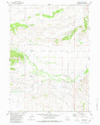 1980 Merna1980 Print · USGSWestern Wyoming ranching country is documented here in the early eighties, centered on the small outpost of Merna. Researchers can locate the local Cem, trace the winding Horse Creek, and identify early resource exploration at the Drill Hole on Beaver Ridge.
 - 1982 Map of Afton
 1982 Afton1982 Print · USGSWestern Wyoming during the early eighties shows a landscape of mountain ranges and valley settlements. Genealogists can trace family names and small towns across Star Valley, while historians can locate the path of the Lander Cutoff and the Cottonwood Mine.
End of results
Showing maps 1-7 of 7
Frequently asked questions
- What are the different types of historical maps available for Merna?
- What is the oldest map of Merna?
- Where can I purchase historical maps of Merna for my home or office?
- Where can I download high-res historical maps of Merna?
- Are there historical topographic maps available for Merna?
- Is there historical aerial imagery available for Merna?
- Where are historical maps of Merna sourced from?