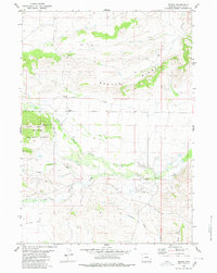
1980 Map of Merna
USGS Topo · Published 1980About this map
The settlement of Merna serves as a focal point in this high-country landscape of western Wyoming, where the drainage of Horse Creek and its branches, the North Horse Creek and South Horse Creek, define the lower terrain. This 1980 edition illustrates a remote ranching and grazing area, with a small Cem located near the main creek bed indicating early pioneer history. To the west, the boundary of the Bridger National Forest begins, rising toward the prominent Merna Butte. The map reveals a complex network of seasonal water sources like Lead Creek and various unnamed Spring and Springs labels. Geologic exploration is evidenced by a solitary Drill Hole on the northern slopes of Beaver Ridge, while long drainage paths such as Brodie Draw and Pasture Draw cut through the high flats and ridges.
Find a feature on this map
19 named features on this map. Tap any name to fly to it.
Don’t see what you’re looking for? This feature index may not catch every label — zoom into the map to look around manually.
Map Details
Editions of this 1980 Merna Map
This is the sole edition of this map. No revisions or reprints were ever made.
Other maps of this area

1907 · Gros Ventre
USGS Topo · 1:125,000

1910 · Gros Ventre
USGS Topo · 1:125,000

1939 · Big Piney
USGS Topo · 1:125,000

1942 · Big Piney
USGS Topo · 1:125,000

1955 · Driggs
USGS Topo · 1:250,000

1955 · Preston
USGS Topo · 1:250,000

1958 · Driggs
USGS Topo · 1:250,000

1958 · Preston
USGS Topo · 1:250,000

1962 · Driggs
USGS Topo · 1:250,000

1962 · Preston
USGS Topo · 1:250,000