1960s Maps of Rock Springs, Wyoming
Explore 6 historic maps of Rock Springs from the 1960s. These maps offer a rare glimpse into what life looked like during the 1960s — showing old roads, neighborhoods, homes, and landmarks that have changed or disappeared over time.
Whether you're researching your family's past, planning a metal detecting trip, or studying how Rock Springs's landscape evolved across the 1960s, these high-resolution maps are a powerful tool for exploring the history of this region.
- Focus on a specific era: All maps on this page are from the 1960s, giving you a focused view of this time period.
- See what’s changed: Compare century-old streets, trails, and buildings to today's modern landscape using overlays and satellite layers.
- Research with precision: Use these maps for genealogy, historical research, land use analysis, or educational projects.
- View, download, or print: Maps are fully viewable online in high resolution, and can be downloaded or printed for your own records.
Start exploring Rock Springs's history through authentic maps from the 1960s. This is your window into the past.
Rock Springs, WY maps
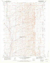
(6)- 1961 Map of Pilot Butte, 1964 Print
 1961 Pilot Butte1964 Print · USGSSweetwater County ranching and transit patterns are preserved here during the early sixties. Researchers can trace historic routes like Chiltons Cutoff or locate landmarks such as Fourteenmile Ranch and Pilot Butte.3 unique versions available
 - 1961 Map of Kanda, 1964 Print
 1961 Kanda1964 Print · USGSSweetwater County at the start of the sixties reveals the intersection of pioneer history and modern infrastructure. You can trace the Overland Trail as it mirrors the Union Pacific line past the settlement of Kanda and Bitter Creek.2 unique versions available
 - 1962 Map of Rock Springs
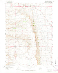
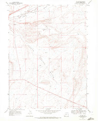
 1962 Rock Springs1962 Print · USGSThe high desert of Sweetwater County in the early 1960s reveals a rugged ranching and energy landscape centered on Rock Springs. Genealogists can trace family holdings like the Erikson-Kent Ranch and Barnhart Ranch alongside the Union Pacific line.
 - 1968 Map of Rock Springs, 1972 Print
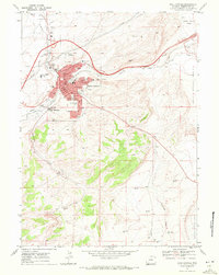 1968 Rock Springs1972 Print · USGSRock Springs and the surrounding Sweetwater County high desert are captured here in the late sixties as the city expanded around its industrial roots. Trace the legacy of the western frontier and energy economy through the Overland Trail, Swanson Mine, and Mountain View Cem.3 unique versions available
 - 1968 Map of Reliance, 1972 Print
 1968 Reliance1972 Print · USGSSweetwater County coal country and rail history are well-documented here in the late sixties. Trace the industrial landscape of the Union Pacific through old settlements like Reliance, Winton, and Dines, or follow the winding Killpecker Creek.
 - 1968 Map of Baxter, 1972 Print
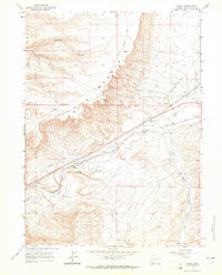
 1968 Baxter1972 Print · USGSSweetwater County during the late sixties serves as a vital corridor for western transit and energy production. Map collectors and historians can trace the historic Overland Trail alongside the Union Pacific rail line and the Rock Springs Airport.2 unique versions available
End of results
Showing maps 1-6 of 6
Top cities near Rock Springs
- North Rock Springs historical maps
- Clearview Acres historical maps
- Reliance historical maps
- Purple Sage historical maps
- Superior historical maps
- Arrowhead Springs historical maps
Top neighborhoods of Rock Springs
Frequently asked questions
- What are the different types of historical maps available for Rock Springs?
- What is the oldest map of Rock Springs?
- Where can I purchase historical maps of Rock Springs for my home or office?
- Where can I download high-res historical maps of Rock Springs?
- Are there historical topographic maps available for Rock Springs?
- Is there historical aerial imagery available for Rock Springs?
- Where are historical maps of Rock Springs sourced from?