Old Maps of Grant Village, Wyoming for Genealogy
Trace your family roots with 16 historic maps of Grant Village. These high-res maps reveal old neighborhoods, homesites, landmarks, and streets — helping you uncover where your ancestors lived and how the area evolved over time.
- Explore historic neighborhoods: Identify where your relatives may have lived in the 1800s or 1900s.
- Compare maps over time: Trace the changes in streets, buildings, and landmarks for multi-generational research.
- Perfect for genealogy & ancestry research: Used by family historians and researchers to map out lineage and migration.
These maps are an incredible resource for exploring your personal connection to Grant Village's past.
Grant Village, WY maps
(16)- 1886 Map of Shoshone
 1886 Shoshone1886 Print · USGSYellowstone's thermal wilderness comes to life in the 1880s, documenting the early park era when the Old Faithful Hotel stood as a rare sign of habitation. Trace the geothermal basins and high peaks from Giant Geyser to Mt Sheridan.
 - 1888 Map of Shoshone, 1896 Print
 1888 Shoshone1896 Print · USGSYellowstone’s hydrothermal wonders are meticulously charted in the 1880s, shortly after the park's founding. Researchers can trace the earliest mapped geysers and springs, from the Old Faithful Hotel to the remote Shoshone Geyser Basin and Mt Sheridan.
 - 1895 Map of Shoshone
 1895 Shoshone1895 Print · USGSYellowstone at the end of the nineteenth century reveals the early footprint of American conservation and tourism. Researchers can trace the original trails and thermal clusters of the Upper Geyser Basin, including the Old Faithful Hotel and Lone Star Geyser.
 - 1901 Map of Shoshone
 1901 Shoshone1901 Print · USGSYellowstone's geothermal wonders and early park boundaries are detailed here during the late Victorian era. Researchers can trace the early footprint of the Old Faithful Hotel and locate remote hydrothermal sites like Shoshone Geyser Basin and Rustic Geyser.
 - 1908 Map of Shoshone
 1908 Shoshone1908 Print · USGSYellowstone's geothermal wonders and early park development appear here during the first decade of the twentieth century. Researchers can trace the trails and landmarks near Old Faithful Hotel and locate remote features like Lone Star Geyser and Shoshone Geyser Basin.
 - 1911 Map of Shoshone
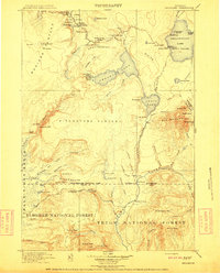 1911 Shoshone1911 Print · USGSThe thermal basins and early back-country outposts of southern Yellowstone are captured here in the early nineteen-hundreds. Trace early tourism and patrol routes through the Shoshone Geyser Basin, the Thumb Hotel, and the Snowshoe Cabin.3 unique versions available
 - 1955 Map of Ashton, 1967 Print
 1955 Ashton1967 Print · USGSThe Greater Yellowstone ecosystem is captured here during the mid-1950s, showing the high plateaus and remote gateway towns of Idaho and Montana. Researchers can trace the Union Pacific line to Ashton or locate small settlements like Squirrel and Grainville.4 unique versions available
 - 1956 Map of West Thumb, 1958 Print
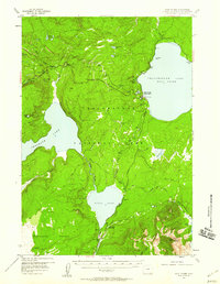 1956 West Thumb1958 Print · USGSYellowstone National Park in the mid-1950s reveals a high-country landscape of geyser basins and glacial lakes. Trace backcountry trails to the Aster Creek Patrol Cabin or explore the hydrothermal activity at Rustic Geyser and the Thumb Paintpots.3 unique versions available
 - 1958 Map of Ashton
 1958 Ashton1958 Print · USGSGreater Yellowstone and the eastern Idaho borderlands appear here in the mid-1950s as rail and road networks connected remote mountain basins. Trace the Union Pacific route through Ashton or locate early outposts like Last Chance, Squirrel, and West Yellowstone.
 - 1960 Map of Ashton
 1960 Ashton1960 Print · USGSThe Idaho-Montana-Wyoming borderlands at the dawn of the sixties show a landscape defined by the Continental Divide and early wilderness tourism. Genealogists and historians can trace rail-stop settlements like Trude Siding, old outposts like Warm River, and early lodging at Snowball Inn.
 - 1982 Map of Yellowstone National Park South, 1983 Print
 1982 Yellowstone National Park South1983 Print · USGSThe southern reaches of Yellowstone and the Teton Wilderness are captured here in the early 1980s, showcasing a landscape of high plateaus and river headwaters. Trace the historic paths of the Two Ocean Pass Trail or locate remote outposts like Flagg Ranch and Grant Village.
 - 1986 Map of West Thumb
 1986 West Thumb1986 Print · USGSYellowstone National Park in the mid-1980s showcased the developed shoreline of the West Thumb and its famous thermal basins. Researchers can locate specific geothermal features like Thumb Paintpots and Beach Geyser or study the layout of Grant Village.
 - 2012 Map of West Thumb, 2012 Print
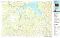
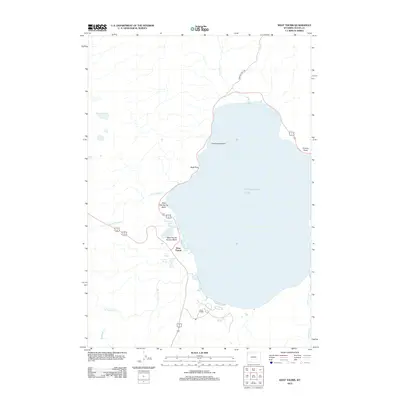 2012 West Thumb2012 Print · USGSCovers Grant Village, including Teton County, United States, and other nearby areas
 - 2015 Map of West Thumb, 2015 Print
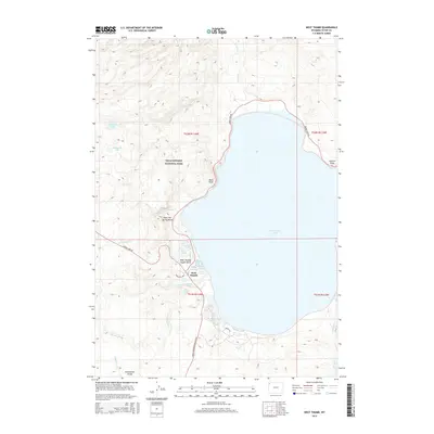 2015 West Thumb2015 Print · USGSCovers Grant Village, including Teton County, United States, and other nearby areas
 - 2017 Map of West Thumb, 2017 Print
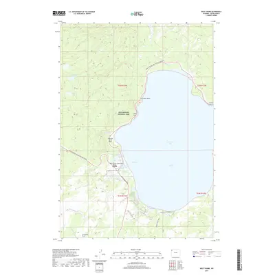 2017 West Thumb2017 Print · USGSCovers Grant Village, including Teton County, United States, and other nearby areas
 - 2021 Map of West Thumb, 2021 Print
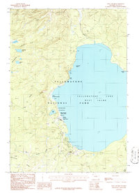
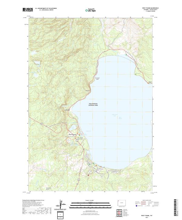 2021 West Thumb2021 Print · USGSThe West Thumb of Yellowstone Lake is shown here in the 2020s, highlighting the intricate geothermal landscape of the geyser basins. Researchers can locate specific hydrothermal features like Fishing Cone, Abyss Pool, and the Thumb Paintpots along the waterfront.
End of results
Showing maps 1-16 of 16
Frequently asked questions
- What are the different types of historical maps available for Grant Village?
- What is the oldest map of Grant Village?
- Where can I purchase historical maps of Grant Village for my home or office?
- Where can I download high-res historical maps of Grant Village?
- Are there historical topographic maps available for Grant Village?
- Is there historical aerial imagery available for Grant Village?
- Where are historical maps of Grant Village sourced from?