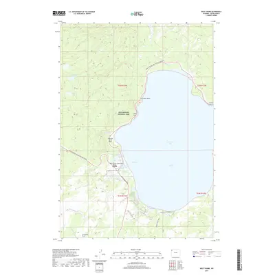
2017 Map of West Thumb
USGS Topo · Published 2017About this map
Yellowstone Lake dominates this 2017 topographic survey, specifically focusing on the geothermal activity surrounding the West Thumb caldera. The hydrothermal features of the West Thumb Geyser Basin are documented in remarkable detail, including Fishing Cone and Abyss Pool. Thermal diversity is evident across the shoreline, with Potts Hot Spring Basin to the north and numerous individual springs like Big Cone Spring and Lakeside Spring clustered near the water's edge.
Find a feature on this map
40 named features on this map. Tap any name to fly to it.
Don’t see what you’re looking for? This feature index may not catch every label — zoom into the map to look around manually.
Map Details
Editions of this 2017 West Thumb Map
This is the sole edition of this map. No revisions or reprints were ever made.
Other maps of this area

1885 · Lake
USGS Topo · 1:125,000

1885 · Gallatin
USGS Topo · 1:125,000

1885 · Gallatin
USGS Topo · 1:125,000

1886 · Shoshone
USGS Topo · 1:125,000

1886 · Canyon
USGS Topo · 1:125,000

1888 · Shoshone
USGS Topo · 1:125,000

1895 · Shoshone
USGS Topo · 1:125,000

1895 · Canyon
USGS Topo · 1:125,000

1895 · Lake
USGS Topo · 1:125,000

1896 · Lake
USGS Topo · 1:125,000