Old Maps of Airport Road, Wyoming for Academic Research
Study the evolution of Airport Road with 9 high-resolution historic maps. Whether you're teaching, researching, or modeling changes in land use, these maps provide essential visual documentation of urban, environmental, and geographic change.
- Analyze long-term change: Track patterns in development, transportation, and natural features.
- Ideal for environmental or urban studies: Support academic projects with primary historical map data.
- Use in the classroom or lab: Educators and researchers rely on these maps to bring historical context to life.
These maps are a powerful tool for teaching, research, and visualizing how Airport Road has changed over the decades.
Airport Road, WY maps
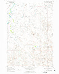
(9)- 1955 Map of Arminto, 1976 Print
 1955 Arminto1976 Print · USGSCentral Wyoming at the mid-century shows a landscape of energy reserves and high-plains ranching. Genealogists and historians can trace the Burlington Northern line through Lost Cabin and the famed Teapot Dome Naval Petroleum Reserve No 3.2 unique versions available
 - 1958 Map of Arminto
 1958 Arminto1958 Print · USGSCentral Wyoming in the late fifties was a landscape of high-plains energy and remote rail outposts. Researchers can trace the Chicago Burlington and Quincy railroad through towns like Arminto and Waltman or locate landmarks like Teapot Rock.
 - 1962 Map of Arminto
 1962 Arminto1962 Print · USGSCentral Wyoming in the early sixties reveals a landscape shaped by the Chicago and North Western railroad and early energy development. Trace the history of the region through remote outposts like Arminto, the US Naval Petroleum Reserve, and the geologic landmark at Hells Half Acre.
 - 1966 Map of Banjo Flats West, 1971 Print
 1966 Banjo Flats West1971 Print · USGSThe Bighorn River valley in the mid-1960s shows a landscape transformed by complex irrigation and ranching. Genealogists and local historians can trace the paths of the Highland Hanover Canal or locate landmarks like Banjo Ranch and the Worland Municipal Airport.3 unique versions available
 - 1979 Map of Nowater Creek, 1980 Print
 1979 Nowater Creek1980 Print · USGSWashakie County ranch lands and drainage basins are captured in detail during the late seventies, showing a landscape of scattered oil fields and seasonal watercourses. Genealogists and historians can trace the Burlington Northern rail line and remote outposts like Nowood and Hampton Ranch.
 - 2012 Map of Banjo Flats West, 2012 Print
 2012 Banjo Flats West2012 Print · USGSCovers Airport Road, including Worland, Washakie County, and other nearby areas
 - 2015 Map of Banjo Flats West, 2015 Print
 2015 Banjo Flats West2015 Print · USGSCovers Airport Road, including Worland, Washakie County, and other nearby areas
 - 2017 Map of Banjo Flats West, 2017 Print
 2017 Banjo Flats West2017 Print · USGSCovers Airport Road, including Worland, Washakie County, and other nearby areas
 - 2021 Map of Banjo Flats West, 2021 Print
 2021 Banjo Flats West2021 Print · USGSThe Bighorn River valley in the early twenty-first century reveals a landscape shaped by irrigation and regional aviation. Trace the path of the Big Horn Canal and Highland Hanover Canal past the Worland Municipal Airport and across the broad expanse of Banjo Flats.
End of results
Showing maps 1-9 of 9
Top cities near Airport Road
Frequently asked questions
- What are the different types of historical maps available for Airport Road?
- What is the oldest map of Airport Road?
- Where can I purchase historical maps of Airport Road for my home or office?
- Where can I download high-res historical maps of Airport Road?
- Are there historical topographic maps available for Airport Road?
- Is there historical aerial imagery available for Airport Road?
- Where are historical maps of Airport Road sourced from?