Old Maps of Your Area
Explore 29 old maps of your area, spanning from 1901 to today. These high-resolution historic maps reveal how streets, neighborhoods, landmarks, and natural features evolved over time — perfect for genealogy, metal detecting, research, and local history exploration.
What you can do with these maps:
- See how your area changed over time: Compare historical maps to modern-day views to trace roads, homesites, rail lines & more.
- View detailed metadata: Each map includes creators, publishers, year, scale, and archive source.
- Overlay maps with satellite & LiDAR: Visualize the past alongside modern tools to explore terrain & human change.
- Trusted historical sources: Maps sourced from the USGS, Library of Congress, and other archives.
- Access maps your way: View online, download high-res files, or order prints for personal or research use.
Start exploring old maps of your area to uncover forgotten places, hidden landmarks, and the deep history beneath your feet.
Nearby maps
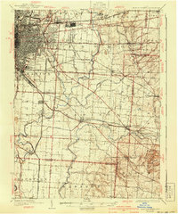
(29)- 1901 Map of Dublin, 1955 Print
 1901 Dublin1955 Print · USGSCovers Columbus, Dublin, and other nearby areas
$29.00+
- 1902 Map of Westerville, 1958 Print
 1902 Westerville1958 Print · USGSCovers Columbus, Westerville, and other nearby areas
$29.00+
- 1903 Map of Dublin, 1939 Print
 1903 Dublin1939 Print · USGSCovers Columbus, Dublin, and other nearby areas2 unique versions available
$29.00+
- 1904 Map of Westerville, 1941 Print
 1904 Westerville1941 Print · USGSCovers Columbus, Westerville, and other nearby areas2 unique versions available
$29.00+
- 1923 Map of West Columbus, 1955 Print
 1923 West Columbus1955 Print · USGSCovers Columbus, Hilliard, and other nearby areas
$29.00+
- 1925 Map of East Columbus, 1940 Print
 1925 East Columbus1940 Print · USGSCovers Columbus, Reynoldsburg, and other nearby areas3 unique versions available
$29.00+
- 1925 Map of West Columbus, 1946 Print
 1925 West Columbus1946 Print · USGSCovers Columbus, Hilliard, and other nearby areas
$29.00+
- 1943 Map of East Columbus, 1943 Print
 1943 East Columbus1943 Print · USGSCovers Columbus, Reynoldsburg, and other nearby areas
$29.00+
- 1947 Map of Columbus, 1948 Print
 1947 Columbus1948 Print · USGSCovers Columbus, Springfield, and other nearby areas
$39.00+
- 1950 Map of Marion, 1950 Print
 1950 Marion1950 Print · USGSCovers Columbus, Newark, and other nearby areas
$39.00+
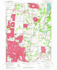
- 1954 Map of Northeast Columbus, 1956 Print
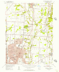 1954 Northeast Columbus1956 Print · USGSCovers Columbus, Westerville, and other nearby areas
$29.00+
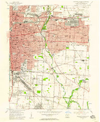
- 1955 Map of Northwest Columbus, 1956 Print
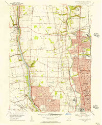 1955 Northwest Columbus1956 Print · USGSCovers Columbus, Dublin, and other nearby areas2 unique versions available
$29.00+
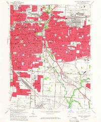
- 1955 Map of Southwest Columbus, 1956 Print
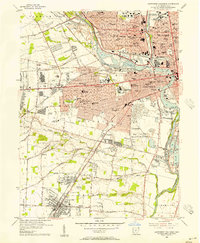 1955 Southwest Columbus1956 Print · USGSCovers Columbus, Upper Arlington, and other nearby areas
$29.00+
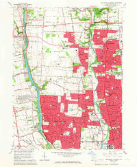
- 1955 Map of Southeast Columbus, 1957 Print
 1955 Southeast Columbus1957 Print · USGSCovers Columbus, Whitehall, and other nearby areas
$29.00+
- 1961 Map of Columbus, 1961 Print
 1961 Columbus1961 Print · USGSCovers Columbus, Springfield, and other nearby areas
$39.00+
- 1962 Map of Marion, 1962 Print
 1962 Marion1962 Print · USGSCovers Columbus, Newark, and other nearby areas
$39.00+
- 1962 Map of Columbus, 1962 Print
 1962 Columbus1962 Print · USGSCovers Columbus, Springfield, and other nearby areas
$39.00+
- 1964 Map of Southeast Columbus, 1966 Print
 1964 Southeast Columbus1966 Print · USGSCovers Columbus, Whitehall, and other nearby areas5 unique versions available
$29.00+
- 1964 Map of Northeast Columbus, 1966 Print
 1964 Northeast Columbus1966 Print · USGSCovers Columbus, Westerville, and other nearby areas4 unique versions available
$29.00+
- 1965 Map of Northwest Columbus, 1967 Print
 1965 Northwest Columbus1967 Print · USGSCovers Columbus, Dublin, and other nearby areas3 unique versions available
$29.00+
- 1965 Map of Southwest Columbus, 1967 Print
 1965 Southwest Columbus1967 Print · USGSCovers Columbus, Upper Arlington, and other nearby areas5 unique versions available
$29.00+
- 1966 Map of Marion, 1968 Print
 1966 Marion1968 Print · USGSCovers Columbus, Newark, and other nearby areas3 unique versions available
$39.00+
- 1967 Map of Columbus, 1969 Print
 1967 Columbus1969 Print · USGSCovers Columbus, Springfield, and other nearby areas2 unique versions available
$39.00+
- 1984 Map of Lancaster, 1985 Print
 1984 Lancaster1985 Print · USGSCovers Columbus, Lancaster, and other nearby areas
$39.00+
- 1986 Map of Bellefontaine, 1986 Print
 1986 Bellefontaine1986 Print · USGSCovers Columbus, Dublin, and other nearby areas
$39.00+
Showing maps 1-25 of 29
Top nearby cities
- Columbus historical maps
- Dublin historical maps
- Westerville historical maps
- Hilliard historical maps
- Upper Arlington historical maps
- Reynoldsburg historical maps
See more
Top nearby counties
- Franklin County historical maps
- Delaware County historical maps
- Licking County historical maps
- Fairfield County historical maps
- Pickaway County historical maps
- Union County historical maps
See more
Frequently asked questions
- What are the different types of historical maps available for my area?
- What is the oldest map of my area?
- Where can I purchase historical maps of my area for my home or office?
- Where can I download high-res historical maps of my area?
- Are there historical topographic maps available for my area?
- Is there historical aerial imagery available for my area?
- Where are historical maps of my area sourced from?