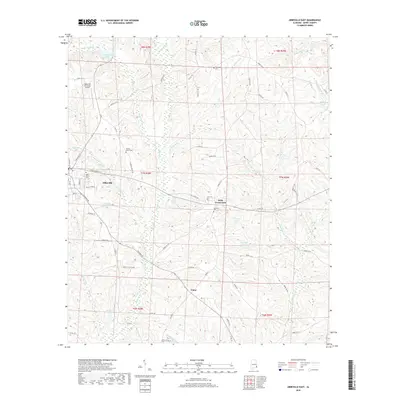
2018 Map of Abbeville East
USGS Topo · Published 2018About this map
Abbeville serves as the focal point of this Henry County landscape, where the town street grid transitions into a network of rural roads and drainage basins. The area is defined by its numerous small ponds and creeks, such as Mathison Lake and Abbie Cr, which weave through the agricultural and forested terrain. A significant number of local cemeteries, including Saint Peters Cem, Ebenezer Cem, and Hickory Grove Cem, are scattered across the quadrangle, indicating long-established family and community ties to the land.
Find a feature on this map
79 named features on this map. Tap any name to fly to it.
Don’t see what you’re looking for? This feature index may not catch every label — zoom into the map to look around manually.
Map Details
Editions of this 2018 Abbeville East Map
This is the sole edition of this map. No revisions or reprints were ever made.
Other maps of this area

1953 · Dothan
USGS Topo · 1:250,000

1954 · Dothan
USGS Topo · 1:250,000

1955 · Dothan
USGS Topo · 1:250,000

1969 · Abbeville West
USGS Topo · 1:24,000

1969 · Fort Gaines
USGS Topo · 1:24,000

1969 · Fort Gaines NW
USGS Topo · 1:24,000

1969 · Fort Gaines NE
USGS Topo · 1:24,000
1969 · Lawrenceville
USGS Topo · 1:24,000

1969 · Abbeville East
USGS Topo · 1:24,000

1969 · Newville
USGS Topo · 1:24,000