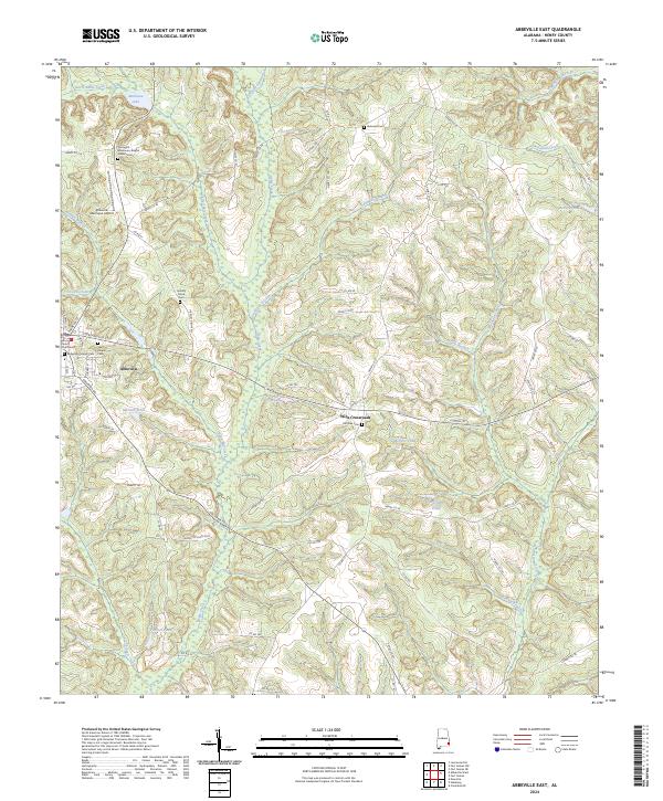
2024 Map of Abbeville East
USGS Topo · Published 2024About this map
Abbeville serves as the focal point of this Henry County landscape, where the Henry County Courthouse marks the local seat of government. The area is characterized by a dense network of watercourses, including the bifurcated flows of Abbie Creek and Little Abbie Creek, which are fed by numerous smaller tributaries like Watford Branch and Galloway Branch. The map reveals a deeply rooted rural community, evidenced by several family-named landmarks and local burial grounds such as the Abbeville Pioneer Cem and Hickory Grove Cem. Further east, the small settlement of Wills Crossroads appears near the Old Zion Cem, while the Abbeville Municipal Airport occupies the northern outskirts. This topography reflects a classic South Alabama pattern of small-town development amidst a web of mill creeks and ponds, including Vann Mill Creek and McRae Mill Creek.
Find a feature on this map
77 named features on this map. Tap any name to fly to it.
Don’t see what you’re looking for? This feature index may not catch every label — zoom into the map to look around manually.
Map Details
Editions of this 2024 Abbeville East Map
This is the sole edition of this map. No revisions or reprints were ever made.
Other maps of this area

1953 · Dothan
USGS Topo · 1:250,000

1954 · Dothan
USGS Topo · 1:250,000

1955 · Dothan
USGS Topo · 1:250,000

1969 · Abbeville West
USGS Topo · 1:24,000

1969 · Fort Gaines
USGS Topo · 1:24,000

1969 · Fort Gaines NW
USGS Topo · 1:24,000

1969 · Fort Gaines NE
USGS Topo · 1:24,000
1969 · Lawrenceville
USGS Topo · 1:24,000

1969 · Abbeville East
USGS Topo · 1:24,000

1969 · Newville
USGS Topo · 1:24,000