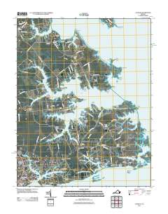
2011 Map of Achilles
USGS Topo · Published 2011About this map
Guinea and the low-lying peninsula between the Severn River and the York River define this coastal landscape at the southern end of Gloucester County. The region's deep ties to the water are evident in the density of landings and wharves, such as Roanes Wharf on the Ware River and Kings Landing near the Perrin River. The interior is dotted with established family and community landmarks, including Oak Grove Cemetery and Old Groves Memorial Cemetery, alongside small crossroads like Achilles, Bena, and Naxera. This maritime character extends to the numerous necks and points, from Ware Neck Point in the north down to Gloucester Banks. Local infrastructure is anchored by several rural post offices and small-scale aviation at Hoffmans Farm Airport, reflecting a community where river-based commerce and overland travel intersect.
Find a feature on this map
134 named features on this map. Tap any name to fly to it.
Don’t see what you’re looking for? This feature index may not catch every label — zoom into the map to look around manually.
Map Details
Editions of this 2011 Achilles Map
This is the sole edition of this map. No revisions or reprints were ever made.
Other maps of this area

1906 · Williamsburg
USGS Topo · 1:62,500

1907 · Yorktown
USGS Topo · 1:62,500

1907 · Hampton
USGS Topo · 1:62,500

1916 · Mathews
USGS Topo · 1:62,500

1917 · Mathews
USGS Topo · 1:62,500

1943 · Yorktown
USGS Topo · 1:62,500

1943 · Richmond
USGS Topo · 1:250,000

1944 · Yorktown
USGS Topo · 1:24,000

1944 · Messick
USGS Topo · 1:24,000

1944 · Harris Grove
USGS Topo · 1:24,000