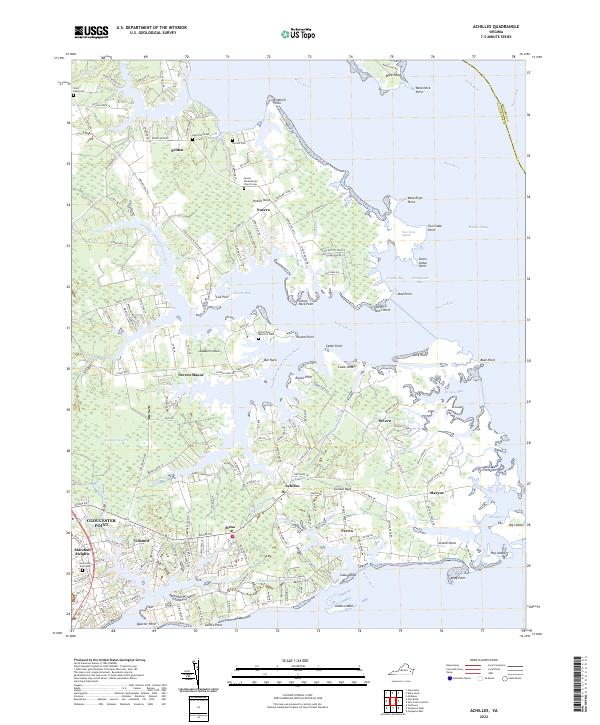
2022 Map of Achilles
USGS Topo · Published 2022About this map
The coastal fingers of Gloucester County are defined by a complex geography of necks and points reaching into the Mobjack Bay and Chesapeake Bay. The settlement pattern follows these ridges, with communities like Achilles, Bena, and Severn situated along the narrow strips of land between tidal waters. This maritime orientation is evident in the naming of nearly every landform, from Guinea Neck to the marshy expanse of Four Point Marsh.
Find a feature on this map
173 named features on this map. Tap any name to fly to it.
Don’t see what you’re looking for? This feature index may not catch every label — zoom into the map to look around manually.
Map Details
Editions of this 2022 Achilles Map
This is the sole edition of this map. No revisions or reprints were ever made.
Other maps of this area

1906 · Williamsburg
USGS Topo · 1:62,500

1907 · Yorktown
USGS Topo · 1:62,500

1907 · Hampton
USGS Topo · 1:62,500

1916 · Mathews
USGS Topo · 1:62,500

1917 · Mathews
USGS Topo · 1:62,500

1943 · Yorktown
USGS Topo · 1:62,500

1943 · Richmond
USGS Topo · 1:250,000

1944 · Yorktown
USGS Topo · 1:24,000

1944 · Messick
USGS Topo · 1:24,000

1944 · Harris Grove
USGS Topo · 1:24,000