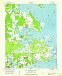
1957 Map of Achilles
USGS Topo · Published 1960About this map
Warner Hall and its surrounding Warner Hall Cem stand at the heart of this coastal Virginia landscape, which is defined by the intricate finger-like peninsulas of Robins Neck, Saddlers Neck, and Jenkins Neck. This mid-century survey reveals a maritime economy and social structure centered around the water, with access points like Roanes Wharf and Severn Wharf providing vital links to the Ware River and Severn River.
Find a feature on this map
98 named features on this map. Tap any name to fly to it.
Don’t see what you’re looking for? This feature index may not catch every label — zoom into the map to look around manually.
Map Details
Editions of this 1957 Achilles Map
This is the sole edition of this map. No revisions or reprints were ever made.
Other maps of this area

1906 · Williamsburg
USGS Topo · 1:62,500

1907 · Yorktown
USGS Topo · 1:62,500

1907 · Hampton
USGS Topo · 1:62,500

1916 · Mathews
USGS Topo · 1:62,500

1917 · Mathews
USGS Topo · 1:62,500

1943 · Yorktown
USGS Topo · 1:62,500

1943 · Richmond
USGS Topo · 1:250,000

1944 · Yorktown
USGS Topo · 1:24,000

1944 · Messick
USGS Topo · 1:24,000

1944 · Harris Grove
USGS Topo · 1:24,000