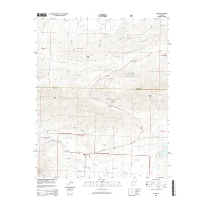
2014 Map of Acorn
USGS Topo · Published 2014About this map
Acorn sits at a significant highway junction where US Hwy 59 and Us-270 meet, serving as a gateway into the heavily wooded ridges of the Ouachita National Forest. The landscape is defined by the headwaters of the Ouachita River and the Irons Fork Reservoir, with the terrain rising sharply toward Fourche Mtn and Round Top Mtn. The map reveals a network of rural routes, such as Dark Forrest Rd and Polk 96 Rd, that connect isolated homesites to the valley floor. Genealogists and local historians can find the Foran Cem located near Foran Gap, marking the historic presence of families in the Gap Creek Valley before much of the surrounding land was consolidated into national forest management.
Find a feature on this map
53 named features on this map. Tap any name to fly to it.
Don’t see what you’re looking for? This feature index may not catch every label — zoom into the map to look around manually.
Map Details
Editions of this 2014 Acorn Map
This is the sole edition of this map. No revisions or reprints were ever made.
Other maps of this area

1879 · Poteau Mountain
USGS Topo · 1:62,500

1887 · Poteau Mountain #1
USGS Topo · 1:62,500

1887 · Poteau Mountain #2
USGS Topo · 1:62,500

1890 · Poteau Mountain
USGS Topo · 1:125,000

1899 · Poteau Mountain
USGS Topo · 1:125,000

1939 · Waldron
USGS Topo · 1:62,500

1940 · Waldron
USGS Topo · 1:62,500

1941 · Waldron
USGS Topo · 1:62,500

1949 · Waldron
USGS Topo · 1:62,500

1950 · Mcalester
USGS Topo · 1:250,000