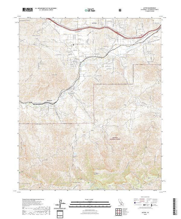
2022 Map of Acton
USGS Topo · Published 2022About this map
The Santa Clara River carves through this high-desert landscape, defining the corridor for both the Soledad Canyon Rd and the early settlements of Acton, Paris, and Ravenna. The 2022 survey illustrates the transition from the relatively open valley floor to the steep southern ascent of the San Gabriel Mountains. High-elevation landmarks like Mt Gleason and Messenger Peak loom over the Angeles National Forest, where remote features like Magnetic Springs and Perspiration Point reflect the area's taxing terrain and local lore.
Find a feature on this map
122 named features on this map. Tap any name to fly to it.
Don’t see what you’re looking for? This feature index may not catch every label — zoom into the map to look around manually.
Map Details
Editions of this 2022 Acton Map
This is the sole edition of this map. No revisions or reprints were ever made.
Other maps of this area

1900 · Tujunga
USGS Topo · 1:62,500

1900 · Fernando
USGS Topo · 1:62,500

1901 · Southern California Sheet No. 1
USGS Topo · 1:250,000

1904 · Southern California Sheet No. 1
USGS Topo · 1:250,000

1915 · Elizabeth Lake
USGS Topo · 1:125,000

1917 · Elizabeth Lake
USGS Topo · 1:125,000

1930 · Ravenna
USGS Topo · 1:24,000

1932 · Red Rover
USGS Topo · 1:24,000

1932 · Palmdale
USGS Topo · 1:24,000
1934 · Ravenna
USGS Topo · 1:24,000