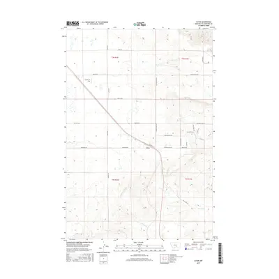
2017 Map of Acton
USGS Topo · Published 2017About this map
Acton sits at the heart of this landscape where the high plains meet the headwaters of several critical drainages in Yellowstone County. The settlement is positioned along a corridor defined by Shepherd Acton Rd and Mainwaring Rd, surrounded by the wide expanses of Comanche Flat. This area is defined by its seasonal water systems, including the N Fork Fivemile Cr, S Fork Fivemile Cr, and the N Fork Alkali Cr, which carve subtle paths through the terrain. To the northeast, the land transitions into a network of ranching roads and residential trails with names like Wapiti Ridge Trl and Wild Horse Trl, reflecting the contemporary character of the region. Local property boundaries and family-named routes such as Sidell Rd, Oswald Rd, and Mammen Rd indicate the established rural framework of this part of Montana.
Find a feature on this map
32 named features on this map. Tap any name to fly to it.
Don’t see what you’re looking for? This feature index may not catch every label — zoom into the map to look around manually.
Map Details
Editions of this 2017 Acton Map
This is the sole edition of this map. No revisions or reprints were ever made.
Other maps of this area

1954 · Billings
USGS Topo · 1:250,000

1954 · Roundup
USGS Topo · 1:250,000

1956 · Comanche
USGS Topo · 1:24,000

1956 · Acton
USGS Topo · 1:24,000

1956 · Hickson Ranch
USGS Topo · 1:24,000

1956 · Rimrock
USGS Topo · 1:24,000

1956 · Two Pine School
USGS Topo · 1:24,000

1957 · Billings
USGS Topo · 1:250,000

1957 · Billings West
USGS Topo · 1:24,000

1958 · Billings
USGS Topo · 1:250,000