
1958 Map of Billings
USGS Topo · Published 1958About this map
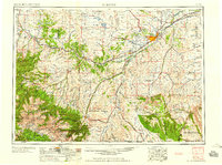
Billings serves as the focal point of this 1958 landscape, situated where the Northern Pacific RR and Chicago Burlington and Quincy RR converge along the Yellowstone River. The geography transitions from the extensive Crow Indian Reservation in the east to the high elevations of the Beartooth Mountains and Custer National Forest in the southwest. This era captures the region's mid-century infrastructure, including U.S. 10 and U.S. 310, which linked ranching and mining communities like Red Lodge, Columbus, and Absarokee. North of the river, the Lake Basin and Hailstone National Wildlife Refuge denote a more arid, depression-filled terrain compared to the lush river valleys. Diverse landmarks like Buffalo Jump and Rattlesnake Butte reflect the long human history and distinct geology of the Yellowstone Valley.
Find a feature on this map
163 named features on this map. Tap any name to fly to it.
Don’t see what you’re looking for? This feature index may not catch every label — zoom into the map to look around manually.
Map Details
Editions of this 1958 Billings Map
2 editions found
Other maps of this area

1886 · Canyon
USGS Topo · 1:125,000

1886 · Little Belt Mts.
USGS Topo · 1:250,000

1889 · Big Snowy Mountain
USGS Topo · 1:250,000

1891 · Livingston
USGS Topo · 1:250,000

1891 · Big Timber
USGS Topo · 1:125,000

1892 · Stillwater
USGS Topo · 1:125,000

1893 · Livingston
USGS Topo · 1:250,000

1893 · Big Snowy Mountain
USGS Topo · 1:250,000

1893 · Big Timber
USGS Topo · 1:125,000

1893 · Huntley
USGS Topo · 1:125,000